|
search place name
|
||
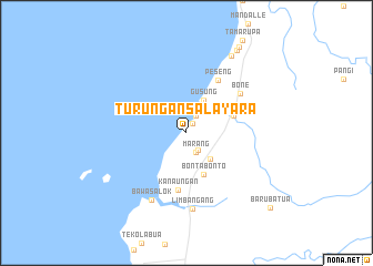
Turungansalayara (Sulawesi Selatan, Indonesia)Turungansalayara is a town in the Sulawesi Selatan region of Indonesia. An overview map of the region around Turungansalayara is displayed below.
regional and 3d topo map of Turungansalayara, Indonesia ::
Turungansalayara airports ::
The nearest airport is UPG - Ujung Pandang Hasanuddin, located 43.9 km south of Turungansalayara.
Nearby towns ::
Langating (1.1km north east) //
Segeri (2.0km north east) //
Pituwe (2.1km south east) //
Marang (2.2km south east) //
Maranae (3.6km south east) //
Gusung (3.7km north east) //
Bontabonto (4.5km south) //
Cempae (5.0km east) //
Kanaungan (5.8km south) //
Peseng (6.2km north east) //
Bone (6.7km north east) //
Bawasalok (7.6km south west) //
Limbangang (7.7km south) //
Limpangan (9.0km north east) //
Rumahraja (9.7km north east) //
Kekeang (10.2km north east) //
Barubatua (11.3km south east) //
[all distances 'as the bird flies' and approximate] 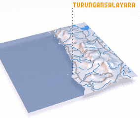 Places with similar names to Turungansalayara, Indonesia :: Disclaimer :: Information on this page comes without warranty of any kind |
||
|
Where is Turungansalayara? Elevation and coordinates ::
Latitude (lat): 4°39'55"S Longitude (lon): 119°32'28"E
Elevation (approx.): 4m (map arrows pan, magnifying glasses zoom) |
||
|
Visiting Turungansalayara? Hotel/Accommodation ::
Book a hotel in Turungansalayara Travel Guide ::
Buy a travel guide for Indonesia rental cars ::
car rental offers GPS waypoint ::
download a GPX waypoint (PoI) of Turungansalayara for your GPS receiver
|
||