|
search place name
|
||
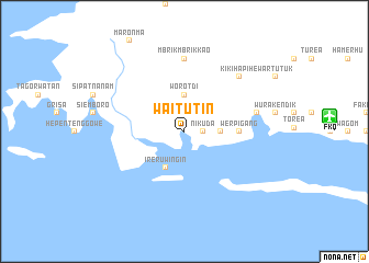
Waitutin (Indonesia)Waitutin is a town in Indonesia. An overview map of the region around Waitutin is displayed below.
regional and 3d topo map of Waitutin, Indonesia ::
Waitutin airports ::
The nearest airport is FKQ - Fak Fak, located 14.9 km east of Waitutin.
Other airports nearby include BXB - Babo (151.8 km east), KNG - Kaimana (190.6 km south east), Nearby towns ::
Henedade (1.9km north) //
Atiationin (1.9km east) //
Nikuda (1.9km east) //
Atti Atti Onin (2.6km north east) //
Worotdi (3.7km north) //
Werbuam (3.7km east) //
Ireruwingin (4.1km south west) //
Maha Timba (5.6km east) //
Tanah Baru (5.6km east) //
Werpigang (5.6km east) //
Parauasap (5.6km east) //
Mbrik Mbrik Kao (7.4km north) //
Werba (7.6km east) //
Kikihapihe (7.9km north east) //
[all distances 'as the bird flies' and approximate] 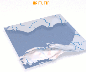 Places with similar names to Waitutin, Indonesia ::
// Waitetuna (NZ)
// Wittdün (DE)
// Wu-t'u-t'an (TW)
// Wu-ti-t'an (TW)
// Wu-ti-t'an (TW)
// Woodton (GB)
// Woodtown (IE)
Disclaimer :: Information on this page comes without warranty of any kind |
||
|
Where is Waitutin? Elevation and coordinates ::
Latitude (lat): 2°56'0"S Longitude (lon): 132°8'0"E
Elevation (approx.): 97m (map arrows pan, magnifying glasses zoom) |
||
|
Visiting Waitutin? Hotel/Accommodation ::
Book a hotel in Waitutin Travel Guide ::
Buy a travel guide for Indonesia rental cars ::
car rental offers GPS waypoint ::
download a GPX waypoint (PoI) of Waitutin for your GPS receiver
|
||