|
search place name
|
||
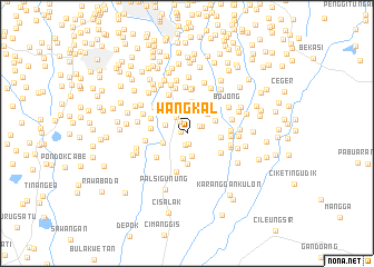
Wangkal (Indonesia)Wangkal is a town in Indonesia. An overview map of the region around Wangkal is displayed below.
regional and 3d topo map of Wangkal, Indonesia ::
Wangkal airports ::
The nearest airport is CGK - Jakarta Soekarno Hatta Intl, located 31.8 km north west of Wangkal.
Nearby towns ::
Pasarrebo (0.6km west) //
Merdika (1.1km south) //
Penggilingan-baru (1.1km north) //
Kampungutan (1.2km south) //
Rambutan (1.4km north west) //
Ceger (1.4km north east) //
Kebanjiran (1.7km north east) //
Kampungtengah (2.0km north west) //
Tanjung-timur (2.3km west) //
Pembilangan (2.4km south) //
Dukuh (2.4km north) //
Ciracas (2.6km south) //
Cijantung (2.6km west) //
Lobangbuaya (2.8km north east) //
Kampungmakasar (2.9km north) //
Makasar (3.0km north west) //
Kampungbaru (3.1km south) //
Rawahmong (3.1km north east) //
Lembur (3.2km north) //
Condetbalekambang (3.2km north west) //
Bambuapus (3.5km east) //
Tanahduaratus (3.5km north east) //
Tanjung-barat (3.6km west) //
Kalimati (3.9km south west) //
Kampungjawa (3.9km west) //
Cilangkap (4.0km south east) //
Gandara Dua (4.0km south) //
Pasarminggu (4.2km north west) //
Kebagusan (4.2km west) //
[all distances 'as the bird flies' and approximate]  Places with similar names to Wangkal, Indonesia ::
// Wangkal (ID)
// Wangkal (ID)
// Wangkal (ID)
// Wangkal (ID)
// Wang Kiel (SD)
// Hwanggae-gol (KP)
// Hwangŭi-gol (KP)
// Wangkal (ID)
// Wangcuoli (CN)
// Wang-kao-liao (TW)
Disclaimer :: Information on this page comes without warranty of any kind |
||
|
Where is Wangkal? Elevation and coordinates ::
Latitude (lat): 6°18'26"S Longitude (lon): 106°52'44"E
Elevation (approx.): 42m (map arrows pan, magnifying glasses zoom) |
||
|
Visiting Wangkal? Hotel/Accommodation ::
Book a hotel in Wangkal Travel Guide ::
Buy a travel guide for Indonesia rental cars ::
car rental offers GPS waypoint ::
download a GPX waypoint (PoI) of Wangkal for your GPS receiver
|
||