|
search place name
|
||
Wesena (Nusa Tenggara Timur, Indonesia)Wesena is a town in the Nusa Tenggara Timur region of Indonesia. An overview map of the region around Wesena is displayed below.
regional and 3d topo map of Wesena, Indonesia ::

Wesena airports ::
The nearest airport is DIL - Dili Presidente Nicolau Lobato Intl, located 143.2 km north east of Wesena.
Nearby towns ::
Kamradek (0.5km south east) //
Lohali (0.6km north west) //
Sinlofas (0.8km south east) //
Maken bala (1.3km south west) //
Oemanas (1.4km south east) //
Banheni A (1.4km north east) //
Hauto (2.0km east) //
Banheni B (2.2km north east) //
Benahe (2.4km east) //
Leohas (2.5km north east) //
Kuanaik (2.7km south) //
Fautana (3.0km south east) //
Bimaku (3.6km east) //
Kabukhala (3.7km south east) //
Aehoen (3.8km east) //
Furuk (4.4km east) //
Fatukriti (4.5km east) //
Raimea 1 (4.6km north) //
Wekmurak (5.4km north west) //
Halioan (5.5km east) //
Hahedan (5.6km east) //
Nirunat (5.8km north) //
Raimea 2 (5.8km north) //
Oeekam (5.9km north) //
Wekmidar (5.9km east) //
Aidois (6.1km north east) //
Laluan (6.1km east) //
Tunuahu (6.5km north) //
Wekaen (6.8km east) //
[all distances 'as the bird flies' and approximate] 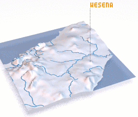 Places with similar names to Wesena, Indonesia ::
Disclaimer :: Information on this page comes without warranty of any kind |
||
|
Where is Wesena? Elevation and coordinates ::
Latitude (lat): 9°35'35"S Longitude (lon): 124°45'27"E
Elevation (approx.): 513m (map arrows pan, magnifying glasses zoom) |
||
|
Visiting Wesena? Hotel/Accommodation ::
Book a hotel in Wesena Travel Guide ::
Buy a travel guide for Indonesia rental cars ::
car rental offers GPS waypoint ::
download a GPX waypoint (PoI) of Wesena for your GPS receiver
|
||