|
search place name
|
||
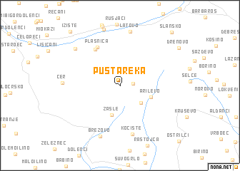
Pusta Reka (Macedonia, The Republic of)Pusta Reka is a town in Macedonia, The Republic of. An overview map of the region around Pusta Reka is displayed below.
regional and 3d topo map of Pusta Reka, Macedonia, The Republic of ::
Pusta Reka airports ::
The nearest airport is OHD - Ohrid, located 43.2 km south west of Pusta Reka.
Other airports nearby include SKP - Skopje (72.2 km north east), KSO - Kastoria Aristotelis (107.9 km south), TIA - Tirana Rinas (120.0 km west), PRN - Pristina (129.2 km north), Nearby towns ::
Gorno Divjaci (1.5km east) //
Dolno Divjaci (3.6km south east) //
Zašle (4.6km south) //
Arilevo (4.0km south east) //
Preglovo (6.4km north west) //
Plasnica (6.6km north west) //
Kočište (7.7km south) //
Brezovo (8.2km south) //
Latovo (8.5km north) //
Dvorci (7.8km north west) //
Dolno Oreovec (9.0km north) //
Ižište (10.2km north west) //
Slansko (10.3km north east) //
[all distances 'as the bird flies' and approximate]  Places with similar names to Pusta Reka, Macedonia, The Republic of ::
Disclaimer :: Information on this page comes without warranty of any kind |
||
|
Where is Pusta Reka? Elevation and coordinates ::
Latitude (lat): 41°24'46"N Longitude (lon): 21°9'20"E
Elevation (approx.): 1143m (map arrows pan, magnifying glasses zoom) |
||
|
Visiting Pusta Reka? Hotel/Accommodation ::
Book a hotel in Pusta Reka Travel Guide ::
rental cars ::
car rental offers GPS waypoint ::
download a GPX waypoint (PoI) of Pusta Reka for your GPS receiver
|
||