|
search place name
|
||
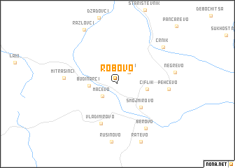
Robovo (Macedonia, The Republic of)Robovo is a town in Macedonia, The Republic of. An overview map of the region around Robovo is displayed below.
regional and 3d topo map of Robovo, Macedonia, The Republic of ::
Robovo airports ::
The nearest airport is SKP - Skopje, located 101.6 km west of Robovo.
Other airports nearby include SOF - Sofia (114.0 km north east), SKG - Thessaloniki Makedonia (139.1 km south), PRN - Pristina (172.2 km north west), KVA - Kavala Megas Alexandros Intl (178.2 km south east), Nearby towns ::
Umlena (2.3km north east) //
Mačevo (2.7km south west) //
Budinarci (3.4km west) //
Čiflik (3.6km east) //
Smojmirovo (4.6km south east) //
Vladimirovo (6.6km south) //
Pehčevo (6.2km east) //
Berovo (7.9km south east) //
Mitrašinci (6.5km west) //
Crnik (8.0km north east) //
Razlovci (9.6km north west) //
[all distances 'as the bird flies' and approximate] 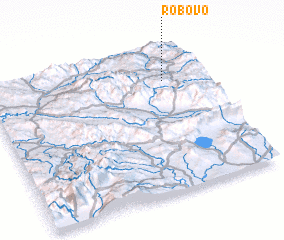 Places with similar names to Robovo, Macedonia, The Republic of ::
Disclaimer :: Information on this page comes without warranty of any kind |
||
|
Where is Robovo? Elevation and coordinates ::
Latitude (lat): 41°46'0"N Longitude (lon): 22°49'0"E
Elevation (approx.): 906m (map arrows pan, magnifying glasses zoom) |
||
|
Visiting Robovo? Hotel/Accommodation ::
Book a hotel in Robovo Travel Guide ::
rental cars ::
car rental offers GPS waypoint ::
download a GPX waypoint (PoI) of Robovo for your GPS receiver
|
||