|
search place name
|
||
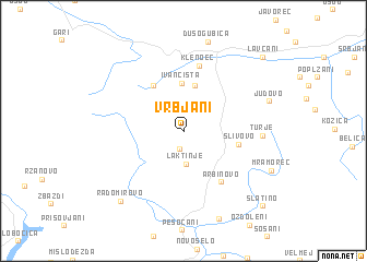
Vrbjani (Macedonia, The Republic of)Vrbjani is a town in Macedonia, The Republic of. An overview map of the region around Vrbjani is displayed below.
regional and 3d topo map of Vrbjani, Macedonia, The Republic of ::
Vrbjani airports ::
The nearest airport is OHD - Ohrid, located 26.7 km south of Vrbjani.
Other airports nearby include TIA - Tirana Rinas (89.8 km west), SKP - Skopje (91.6 km north east), KSO - Kastoria Aristotelis (115.4 km south), PRN - Pristina (129.9 km north), Nearby towns ::
Godivje (1.8km south) //
Laktinje (3.3km south) //
Popoec (4.8km north) //
Ivančišta (4.9km north) //
Ehlovec (5.3km north west) //
Slivovo (4.4km east) //
Arbinovo (6.0km south east) //
Klenoec (6.8km north) //
Turje (6.0km east) //
Judovo (7.2km north east) //
Radomirovo (8.5km south west) //
Slatino (9.8km south east) //
Lavčani (9.7km north east) //
[all distances 'as the bird flies' and approximate] 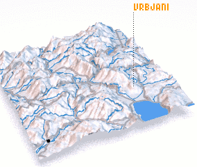
Disclaimer :: Information on this page comes without warranty of any kind |
||
|
Where is Vrbjani? Elevation and coordinates ::
Latitude (lat): 41°25'3"N Longitude (lon): 20°47'39"E
Elevation (approx.): 928m (map arrows pan, magnifying glasses zoom) |
||
|
Visiting Vrbjani? Hotel/Accommodation ::
Book a hotel in Vrbjani Travel Guide ::
rental cars ::
car rental offers GPS waypoint ::
download a GPX waypoint (PoI) of Vrbjani for your GPS receiver
|
||