|
search place name
|
||
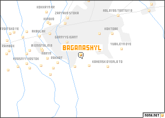
Baganashyl (Almatinskaya Oblastʼ, Kazakhstan)Baganashyl is a town in the Almatinskaya Oblastʼ region of Kazakhstan. An overview map of the region around Baganashyl is displayed below.
regional and 3d topo map of Baganashyl, Kazakhstan ::
Baganashyl airports ::
The nearest airport is ALA - Alma-ata Almaty, located 19.8 km north east of Baganashyl.
Nearby towns ::
Yermensay (1.9km south east) //
Ekinshi Beszhyldyq (2.1km south west) //
Vtoraya Pyatiletka (2.1km south west) //
Gornyy Gigant (3.5km north east) //
(( Gornyy Gigant )) (4.6km north west) //
Rakhat (4.2km west) //
Kamenskoye Plato (4.5km east) //
Almaty (6.4km north east) //
Almaty (6.4km north east) //
Kuramys (5.3km south west) //
Mamyr (5.8km west) //
Karagayly (6.4km south west) //
Koktobe (7.6km north east) //
Qurylysshy (8.6km north) //
Yubileynoye (6.8km east) //
Tastak (7.9km north west) //
Kirovo (9.7km north west) //
Kirovo (10.1km north west) //
Kīrov (10.1km north west) //
[all distances 'as the bird flies' and approximate] 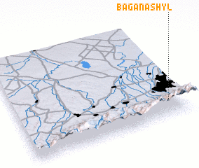 Places with similar names to Baganashyl, Kazakhstan :: Disclaimer :: Information on this page comes without warranty of any kind |
||
|
Where is Baganashyl? Elevation and coordinates ::
Latitude (lat): 43°11'55"N Longitude (lon): 76°54'55"E
Elevation (approx.): 970m (map arrows pan, magnifying glasses zoom) |
||
|
Visiting Baganashyl? Hotel/Accommodation ::
Book a hotel in Baganashyl Travel Guide ::
Buy a travel guide for Kazakhstan rental cars ::
car rental offers GPS waypoint ::
download a GPX waypoint (PoI) of Baganashyl for your GPS receiver
|
||