|
search place name
|
||
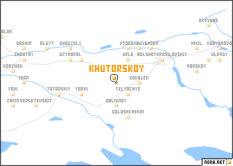
Khutorskoy (Kökshetaū, Kazakhstan)Khutorskoy is a town in the Kökshetaū region of Kazakhstan. An overview map of the region around Khutorskoy is displayed below.
regional and 3d topo map of Khutorskoy, Kazakhstan ::
Khutorskoy airports ::
The nearest airport is ASF - Astrakhan, located 97.0 km west of Khutorskoy.
Nearby towns ::
Kasparkin (0.0km north) //
Poperechnyy (1.9km north) //
Telyachʼye (2.2km south east) //
Kovalëv (2.5km east) //
Oblivnoy (3.7km south) //
Urle (3.9km north) //
Goloshchëkin (5.7km south) //
Kayshaga (5.7km north) //
Yarki (4.2km south west) //
Vtoroy Buyergen (6.1km north east) //
Shagyrly (5.3km north west) //
Malyy Yagodnyy (6.7km north east) //
Bolʼshoye Ganyushkino (6.3km north east) //
Maloye Ganyushkino (6.3km north east) //
Ganyushkīno (6.3km north east) //
Bolʼshoy Krasilovskiy (6.3km north east) //
Tala (6.3km north west) //
Uzynaral (6.3km north west) //
Bedra (7.5km north west) //
Shagyrly (7.5km north west) //
[all distances 'as the bird flies' and approximate]  Places with similar names to Khutorskoy, Kazakhstan ::
Disclaimer :: Information on this page comes without warranty of any kind |
||
|
Where is Khutorskoy? Elevation and coordinates ::
Latitude (lat): 46°34'0"N Longitude (lon): 49°12'0"E
Elevation (approx.): -29m (map arrows pan, magnifying glasses zoom) |
||
|
Visiting Khutorskoy? Hotel/Accommodation ::
Book a hotel in Khutorskoy Travel Guide ::
Buy a travel guide for Kazakhstan rental cars ::
car rental offers GPS waypoint ::
download a GPX waypoint (PoI) of Khutorskoy for your GPS receiver
|
||