|
search place name
|
||
Tambaytobe (Kökshetaū, Kazakhstan)Tambaytobe is a town in the Kökshetaū region of Kazakhstan. An overview map of the region around Tambaytobe is displayed below.
regional and 3d topo map of Tambaytobe, Kazakhstan ::

Tambaytobe airports ::
The nearest airport is URA - Uralsk, located 52.5 km north east of Tambaytobe.
Nearby towns ::
Dyussay-Tyube (1.9km south) //
Novostroyka (4.0km north west) //
Ulʼkenenbek (5.7km south) //
Zhastalap (6.0km north west) //
Kyshi-Enbek (7.5km south) //
[all distances 'as the bird flies' and approximate] 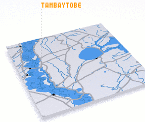 Places with similar names to Tambaytobe, Kazakhstan ::
// Tmat Baeuy (KH)
// Diama Toubé (SN)
// Timtubi (NG)
// Toumi Diabi (ML)
// Dumbit 1 (PG)
// Diêm Tiêu (1) (VN)
// Tomtebo (SE)
// Tomteby (SE)
Disclaimer :: Information on this page comes without warranty of any kind |
||
|
Where is Tambaytobe? Elevation and coordinates ::
Latitude (lat): 50°43'0"N Longitude (lon): 51°15'0"E
Elevation (approx.): 24m (map arrows pan, magnifying glasses zoom) |
||
|
Visiting Tambaytobe? Hotel/Accommodation ::
Book a hotel in Tambaytobe Travel Guide ::
Buy a travel guide for Kazakhstan rental cars ::
car rental offers GPS waypoint ::
download a GPX waypoint (PoI) of Tambaytobe for your GPS receiver
|
||