|
search place name
|
||
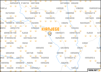
Kianjege (Central, Kenya)Kianjege is a town in the Central region of Kenya. An overview map of the region around Kianjege is displayed below.
regional and 3d topo map of Kianjege, Kenya ::
nearby GPS traces from timatio ::
Kianjege airports ::
The nearest airport is WIL - Nairobi Wilson, located 91.4 km south west of Kianjege.
Other airports nearby include EDL - Eldoret Intl (238.3 km north west), Nearby towns ::
Thangathe (1.9km west) //
Gatina (2.6km north west) //
Kiuu (3.7km south) //
Kibingoti (3.7km east) //
Gatissa (4.1km south east) //
Mururiini (4.1km south east) //
Gachuku (5.2km north west) //
Kibirigwi (5.2km north east) //
Thengeini (5.6km north) //
Giathugu One (5.9km west) //
Gatithi (5.9km east) //
Githunguri (5.9km west) //
Kimondo (5.9km west) //
Ndimaini (5.9km north) //
Kangocho (5.9km north) //
Kiamabara (6.7km north west) //
Karuiro (6.7km south west) //
Mukore (6.7km north west) //
Kagumoini (6.7km north west) //
Kiburu (6.7km north east) //
Kianjiru (6.7km north east) //
Karundu (7.4km west) //
Miirini (7.4km west) //
Ndaroini (7.4km north) //
Giathugu Two (7.6km west) //
Ichamara (7.6km west) //
Gacharu (7.9km south east) //
Thanu (8.3km south west) //
Karima (8.3km south east) //
[all distances 'as the bird flies' and approximate] 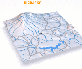 Places with similar names to Kianjege, Kenya ::
Disclaimer :: Information on this page comes without warranty of any kind |
||
|
Where is Kianjege? Elevation and coordinates ::
Latitude (lat): 0°34'0"S Longitude (lon): 37°9'0"E
Elevation (approx.): 1499m (map arrows pan, magnifying glasses zoom) |
||
|
Visiting Kianjege? Hotel/Accommodation ::
Book a hotel in Kianjege Travel Guide ::
Buy a travel guide for Kenya rental cars ::
car rental offers GPS waypoint ::
download a GPX waypoint (PoI) of Kianjege for your GPS receiver
|
||