|
search place name
|
||
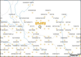
Unjiru (Central, Kenya)Unjiru is a town in the Central region of Kenya. An overview map of the region around Unjiru is displayed below.
regional and 3d topo map of Unjiru, Kenya ::
Unjiru airports ::
The nearest airport is WIL - Nairobi Wilson, located 102.1 km south of Unjiru.
Other airports nearby include EDL - Eldoret Intl (229.4 km north west), Nearby towns ::
Karura (1.9km east) //
Ngandu (1.9km west) //
Nitimaini (2.6km north east) //
Kanyama (2.6km south west) //
Kiawarigi (2.6km north west) //
Ihwagi (3.7km east) //
Kiamucheru (3.7km north) //
Rititi (3.7km west) //
Kiangararu (4.1km south east) //
Githima (4.1km south west) //
Itiati (4.1km north west) //
Giaitu (4.1km south west) //
Kaiyaba (4.1km south west) //
Giakaibii (5.2km north east) //
Gathehu (5.2km north east) //
Kamunyaka (5.2km south east) //
Giakibii (5.2km north east) //
Giagatika (5.2km south west) //
Gaturiri (5.6km south) //
Gaikuyu (5.9km north) //
Karogoto (5.9km south) //
Kamatu (5.9km south) //
Ithaithi (5.9km west) //
Githima (5.9km west) //
Ruthagati (5.9km west) //
Ndaroini (6.7km south east) //
Mutathiini (6.7km south west) //
Mathiyas (7.4km east) //
Kiamabara (7.4km south) //
[all distances 'as the bird flies' and approximate] 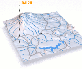 Places with similar names to Unjiru, Kenya ::
Disclaimer :: Information on this page comes without warranty of any kind |
||
|
Where is Unjiru? Elevation and coordinates ::
Latitude (lat): 0°27'0"S Longitude (lon): 37°7'0"E
Elevation (approx.): 1811m (map arrows pan, magnifying glasses zoom) |
||
|
Visiting Unjiru? Hotel/Accommodation ::
Book a hotel in Unjiru Travel Guide ::
Buy a travel guide for Kenya rental cars ::
car rental offers GPS waypoint ::
download a GPX waypoint (PoI) of Unjiru for your GPS receiver
|
||