|
search place name
|
||
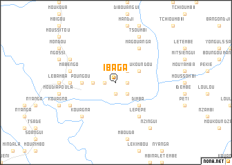
Ibaga (Ngounié, Gabon)Ibaga is a town in the Ngounié region of Gabon. An overview map of the region around Ibaga is displayed below.
regional and 3d topo map of Ibaga, Gabon ::
Ibaga airports ::
The nearest airport is MVB - Franceville Mvengue, located 214.9 km east of Ibaga.
Other airports nearby include LBQ - Lambarene (222.5 km north west), Nearby towns ::
Ndendé (1.9km west) //
Mahounda (1.9km west) //
Kanda (1.9km west) //
Loukila (1.9km south) //
Moukanza (1.9km east) //
Ikoya (1.9km south) //
Kondiri (2.6km south east) //
Missigou (2.6km north east) //
Lemboumbou (3.7km west) //
Bouroumba (3.7km west) //
Moukoundou (4.1km north east) //
Dimba (5.2km south east) //
Poungou (5.6km west) //
Fouroumanga (5.6km west) //
Lepepe (6.7km south east) //
Diboundi (6.7km south east) //
Magouanga (6.7km north east) //
Madioumba (6.7km north east) //
Iméno (7.4km west) //
Mabengo (7.6km west) //
Itogo (7.6km west) //
Kouagna (7.9km south west) //
Boungolo (8.3km south west) //
Boukandi (8.3km north west) //
Moukouagna (8.3km north east) //
Tsoumbi (8.3km north east) //
Nzingui (9.3km south east) //
Ikone (9.3km south east) //
[all distances 'as the bird flies' and approximate] 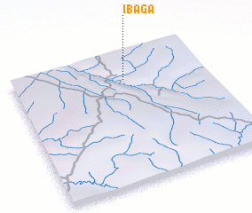 Places with similar names to Ibaga, Gabon ::
Disclaimer :: Information on this page comes without warranty of any kind |
||
|
Where is Ibaga? Elevation and coordinates ::
Latitude (lat): 2°12'0"S Longitude (lon): 11°35'0"E
Elevation (approx.): 343m (map arrows pan, magnifying glasses zoom) |
||
|
Visiting Ibaga? Hotel/Accommodation ::
Book a hotel in Ibaga Travel Guide ::
Buy a travel guide for Gabon rental cars ::
car rental offers GPS waypoint ::
download a GPX waypoint (PoI) of Ibaga for your GPS receiver
|
||