|
search place name
|
||
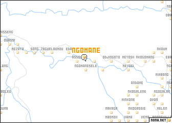
Ngomane (Woleu-Ntem, Gabon)Ngomane is a town in the Woleu-Ntem region of Gabon. An overview map of the region around Ngomane is displayed below.
regional and 3d topo map of Ngomane, Gabon ::
Ngomane airports ::
The nearest airport is BMM - Bitam, located 46.8 km west of Ngomane.
Other airports nearby include OYE - Oyem (79.2 km south west), YAO - Yaounde Ville (187.5 km north), MKU - Makokou (208.9 km south east), Nearby towns ::
Ngomane-Sélé (1.9km south) //
Assok (1.9km west) //
Movous II (1.9km east) //
Movous I (4.1km south east) //
Eda (4.1km north west) //
Akoulazork (5.6km east) //
Odjingoto (5.6km east) //
Zoguéloumou (7.6km west) //
[all distances 'as the bird flies' and approximate] 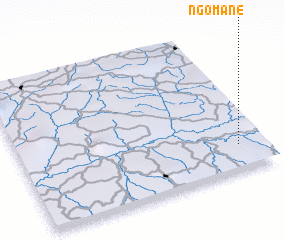 Places with similar names to Ngomane, Gabon ::
// Ngamin (MM)
// Ngomuin (CM)
// Ngomban (CM)
// Nowy Kamień (PL)
// Na Kamenu (BA)
// Nkambeni (ZA)
// Ngomani II (TD)
// Nekmaneo (ID)
// Ngambon (ID)
// Nikoman (MK)
Disclaimer :: Information on this page comes without warranty of any kind |
||
|
Where is Ngomane? Elevation and coordinates ::
Latitude (lat): 2°11'0"N Longitude (lon): 11°54'0"E
Elevation (approx.): 619m (map arrows pan, magnifying glasses zoom) |
||
|
Visiting Ngomane? Hotel/Accommodation ::
Book a hotel in Ngomane Travel Guide ::
Buy a travel guide for Gabon rental cars ::
car rental offers GPS waypoint ::
download a GPX waypoint (PoI) of Ngomane for your GPS receiver
|
||