|
search place name
|
||
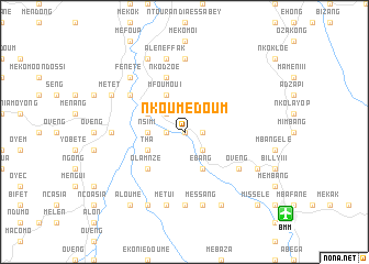
Nkoumédoum (Woleu-Ntem, Gabon)Nkoumédoum is a town in the Woleu-Ntem region of Gabon. An overview map of the region around Nkoumédoum is displayed below.
regional and 3d topo map of Nkoumédoum, Gabon ::
Nkoumédoum airports ::
The nearest airport is BMM - Bitam, located 13.2 km south east of Nkoumédoum.
Other airports nearby include OYE - Oyem (70.1 km south), BSG - Bata (179.4 km west), YAO - Yaounde Ville (186.9 km north), MKU - Makokou (240.2 km south east), Nearby towns ::
Essangui (0.0km north) //
Nkolessong (1.9km west) //
Mékomo (1.9km east) //
Mfoumou II (2.6km north west) //
Ebang (2.6km south east) //
Nsimi (3.7km west) //
Ebang (4.1km south east) //
Mfoumou I (4.1km north west) //
Messon Effak (4.1km north west) //
Mékomo Esseng (4.1km north west) //
Meyo-Kyé (4.1km north west) //
Méboko (4.1km north west) //
Tha (4.1km south west) //
Nka (4.1km south west) //
Olam-Nzé (5.2km south west) //
Bikas Essangui (5.9km north) //
Nkodzoé (5.9km north) //
Gnanamé (5.9km north) //
Oveng (6.7km south east) //
Akom Bong (6.7km north west) //
Médoumou (7.4km south) //
Mékomo II (7.4km north) //
Mékomo III (7.4km north) //
Eson (7.4km west) //
Abang (7.4km west) //
Ebebiyín (7.4km west) //
Messang (7.6km south) //
Métui (7.6km south) //
Mékomo (7.6km north) //
[all distances 'as the bird flies' and approximate] 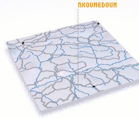 Places with similar names to Nkoumédoum, Gabon ::
// Ncumedum (GQ)
Disclaimer :: Information on this page comes without warranty of any kind |
||
|
Where is Nkoumédoum? Elevation and coordinates ::
Latitude (lat): 2°9'0"N Longitude (lon): 11°24'0"E
Elevation (approx.): 571m (map arrows pan, magnifying glasses zoom) |
||
|
Visiting Nkoumédoum? Hotel/Accommodation ::
Book a hotel in Nkoumédoum Travel Guide ::
Buy a travel guide for Gabon rental cars ::
car rental offers GPS waypoint ::
download a GPX waypoint (PoI) of Nkoumédoum for your GPS receiver
|
||