|
search place name
|
||
Agbledomi (Ghana)Agbledomi is a town in Ghana. An overview map of the region around Agbledomi is displayed below.
regional and 3d topo map of Agbledomi, Ghana ::

Agbledomi airports ::
The nearest airport is LFW - Lome Gnassingbe Eyadema Intl, located 72.6 km north east of Agbledomi.
Other airports nearby include ACC - Accra Kotoka Intl (101.3 km west), COO - Cotonou Cadjehoun (194.1 km east), Nearby towns ::
Atiteti (0.0km north) //
Detom (1.9km north) //
Anyanui (1.9km north) //
Atokogblefo (1.8km east) //
Adidokpo (2.6km north west) //
Tunu (3.7km north) //
Dzita (3.7km east) //
Havi (4.1km north west) //
Dodukpo (5.2km north west) //
Gamendu (5.2km north west) //
Nlablakpo (5.2km north west) //
Azizanu (5.5km west) //
Batefe (5.5km east) //
Bomigo (5.9km north) //
Aholupu (5.8km west) //
Agbletokwei (6.7km north west) //
Adewuke (7.6km west) //
Jisakope (7.8km north west) //
Salo (7.8km north east) //
Koshikofe (8.3km north west) //
Dzogbove (8.3km north west) //
Agbokpi (8.3km north west) //
Akalove (9.2km north west) //
Apinkpo (9.2km north west) //
Agotaga (10.5km north west) //
Floto (10.5km north east) //
[all distances 'as the bird flies' and approximate] 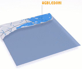 Places with similar names to Agbledomi, Ghana ::
// Agbladomé (TG)
Disclaimer :: Information on this page comes without warranty of any kind |
||
|
Where is Agbledomi? Elevation and coordinates ::
Latitude (lat): 5°46'0"N Longitude (lon): 0°44'0"W
Elevation (approx.): -32768m (map arrows pan, magnifying glasses zoom) |
||
|
Visiting Agbledomi? Hotel/Accommodation ::
Book a hotel in Agbledomi Travel Guide ::
Buy a travel guide for Ghana rental cars ::
car rental offers GPS waypoint ::
download a GPX waypoint (PoI) of Agbledomi for your GPS receiver
|
||