|
search place name
|
||
Akpotoenu (Volta, Ghana)Akpotoenu is a town in the Volta region of Ghana. An overview map of the region around Akpotoenu is displayed below.
regional and 3d topo map of Akpotoenu, Ghana ::

Akpotoenu airports ::
The nearest airport is LFW - Lome Gnassingbe Eyadema Intl, located 21.7 km east of Akpotoenu.
Other airports nearby include COO - Cotonou Cadjehoun (147.6 km east), ACC - Accra Kotoka Intl (150.7 km south west), Nearby towns ::
Akpotoenu New Town (0.8km north west) //
Zukpe (1.1km east) //
Kémavo (1.8km east) //
Kéhodou (2.1km east) //
Asyabi (2.3km east) //
Mésan (2.3km north east) //
Akancha (2.5km north) //
Adyényénya (2.5km east) //
Evohoun (2.5km north) //
Fyégbo (2.5km north east) //
Fenyi Achagome (2.7km north west) //
Zigbli (2.8km south east) //
Kpoglo (3.0km south east) //
Kpoglo (3.2km south) //
Anyigbademe (3.3km south west) //
Komla (3.3km north) //
Adokpo (3.5km north east) //
Akato Avoémé (3.5km east) //
Apéléte (3.6km north) //
Mikéso (3.8km north) //
Djikousére (3.8km north east) //
Fenyi Hata (3.9km north west) //
Fenyi Yokoe (3.9km north west) //
Ablogbé (3.9km north east) //
Asogo (4.0km south) //
Afangbédji (4.0km north east) //
Tékpolo (4.0km north east) //
Tadzle (4.2km west) //
Kouvi (4.2km south east) //
[all distances 'as the bird flies' and approximate] 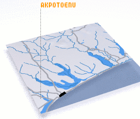
Disclaimer :: Information on this page comes without warranty of any kind |
||
|
Where is Akpotoenu? Elevation and coordinates ::
Latitude (lat): 6°11'42"N Longitude (lon): 1°3'38"E
Elevation (approx.): 41m (map arrows pan, magnifying glasses zoom) |
||
|
Visiting Akpotoenu? Hotel/Accommodation ::
Book a hotel in Akpotoenu Travel Guide ::
Buy a travel guide for Ghana rental cars ::
car rental offers GPS waypoint ::
download a GPX waypoint (PoI) of Akpotoenu for your GPS receiver
|
||