|
search place name
|
||
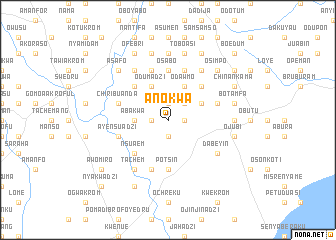
Anokwa (Ghana)Anokwa is a town in Ghana. An overview map of the region around Anokwa is displayed below.
regional and 3d topo map of Anokwa, Ghana ::
Anokwa airports ::
The nearest airport is ACC - Accra Kotoka Intl, located 49.4 km east of Anokwa.
Other airports nearby include TKD - Takoradi (146.4 km south west), LFW - Lome Gnassingbe Eyadema Intl (218.2 km east), NYI - Sunyani (281.0 km north west), Nearby towns ::
Buruata (1.8km east) //
Odominadzi (1.9km south) //
Kwamfokwa (1.9km north) //
Esiwukroa (1.9km north) //
Echifikwa (1.8km west) //
Dankwakrom (2.6km north east) //
Ndebehi (3.7km west) //
Abakwa (3.7km west) //
Odawmo (4.1km north east) //
Atakwa (4.1km north east) //
Odumadzi (4.1km north west) //
Amuanda (4.1km north east) //
Amumukwa (5.2km north west) //
Nsuaem (5.2km south west) //
Aboansa (5.2km north east) //
Potsin (5.6km south) //
Osabo (5.6km north) //
Akwechi (5.9km north) //
Adzintam (5.9km south) //
Ochokrom (5.9km north) //
Opafukrom (5.9km south) //
Akramang (5.8km east) //
Ayensuadzi (5.8km west) //
Chiribuanda (5.8km west) //
Dabeyin (6.7km south east) //
Ewurukwa (6.7km south east) //
Kwachekrom (6.7km north west) //
Mensakwa (6.7km north east) //
Tachem (6.7km south west) //
[all distances 'as the bird flies' and approximate] 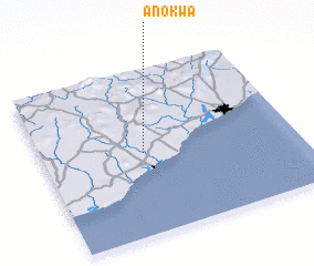 Places with similar names to Anokwa, Ghana ::
Disclaimer :: Information on this page comes without warranty of any kind |
||
|
Where is Anokwa? Elevation and coordinates ::
Latitude (lat): 5°30'0"N Longitude (lon): 0°36'0"W
Elevation (approx.): 54m (map arrows pan, magnifying glasses zoom) |
||
|
Visiting Anokwa? Hotel/Accommodation ::
Book a hotel in Anokwa Travel Guide ::
Buy a travel guide for Ghana rental cars ::
car rental offers GPS waypoint ::
download a GPX waypoint (PoI) of Anokwa for your GPS receiver
|
||