|
search place name
|
||
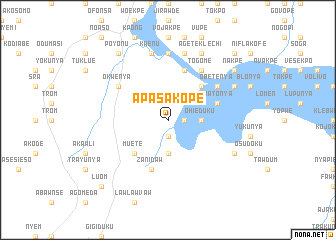
Apasakope (Ghana)Apasakope is a town in Ghana. An overview map of the region around Apasakope is displayed below.
regional and 3d topo map of Apasakope, Ghana ::
Apasakope airports ::
The nearest airport is ACC - Accra Kotoka Intl, located 59.0 km south west of Apasakope.
Other airports nearby include LFW - Lome Gnassingbe Eyadema Intl (128.3 km east), TKD - Takoradi (244.8 km south west), Nearby towns ::
Dawhe (1.8km east) //
Luepunya (1.9km south) //
Kajanya (3.7km east) //
Ohieduku (3.7km east) //
Chondawnya (3.7km south) //
Amedika (5.2km north east) //
Akuse (5.2km north east) //
Muete (5.2km south west) //
Awatonya (5.8km east) //
Latriku (5.9km north) //
Zanidaw (5.9km south) //
Togome (6.7km north east) //
Kosokakofe (6.7km north east) //
Pochenu (6.7km north east) //
Manhaim (6.7km north east) //
Obetenya (6.7km north east) //
Okwenya (6.7km north west) //
Dakekome (7.4km north) //
Abombanya (7.4km north) //
Asale (7.6km north) //
Kwenu (7.6km north) //
Dadehnovinya (7.6km north) //
Blikatako (7.6km north) //
Fojoku (7.6km north) //
Ageteklechi (8.3km north east) //
Dawmelan (8.3km north east) //
Lanaw (8.3km south east) //
Poyonu (9.2km north west) //
Okwenya (9.2km north west) //
[all distances 'as the bird flies' and approximate] 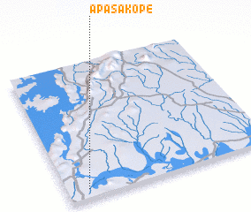 Places with similar names to Apasakope, Ghana :: Disclaimer :: Information on this page comes without warranty of any kind |
||
|
Where is Apasakope? Elevation and coordinates ::
Latitude (lat): 6°4'0"N Longitude (lon): 0°6'0"W
Elevation (approx.): 30m (map arrows pan, magnifying glasses zoom) |
||
|
Visiting Apasakope? Hotel/Accommodation ::
Book a hotel in Apasakope Travel Guide ::
Buy a travel guide for Ghana rental cars ::
car rental offers GPS waypoint ::
download a GPX waypoint (PoI) of Apasakope for your GPS receiver
|
||