|
search place name
|
||
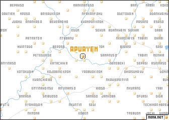
Apuayem (Ghana)Apuayem is a town in Ghana. An overview map of the region around Apuayem is displayed below.
regional and 3d topo map of Apuayem, Ghana ::
Apuayem airports ::
The nearest airport is NYI - Sunyani, located 87.7 km north west of Apuayem.
Other airports nearby include TKD - Takoradi (201.6 km south), ACC - Accra Kotoka Intl (224.7 km south east), Nearby towns ::
Odumasi (0.0km north) //
Jetua (1.8km west) //
Bedabuokrom (1.8km west) //
Brawsanko (2.6km north west) //
Kontomrekrom (2.6km north east) //
Sisiko (4.1km south west) //
Bedifi (4.1km south west) //
Yaobuokrom (4.1km south east) //
Ntabanu (5.2km north west) //
Tanansi (5.2km south east) //
Sampruso (5.5km east) //
Edum (5.9km north) //
Beposo (5.8km west) //
Kobi (5.8km east) //
Katachiwa (5.8km west) //
Asakraka (6.7km north east) //
Sewua (6.7km north east) //
Kojobinekrom (6.7km south west) //
Abasuakuma (7.4km west) //
Abasuapayin (7.4km west) //
Kwamponkrom (7.6km north) //
Hiamenkwan (7.6km north) //
Mpesetia (7.6km south) //
Akrofrom (7.6km east) //
Nerebehi (7.6km east) //
Jwehen (7.6km east) //
Nkawiekuma (7.8km south east) //
Ananta (8.3km north west) //
Anyinamso (8.2km south west) //
[all distances 'as the bird flies' and approximate] 
Disclaimer :: Information on this page comes without warranty of any kind |
||
|
Where is Apuayem? Elevation and coordinates ::
Latitude (lat): 6°43'0"N Longitude (lon): 1°52'0"W
Elevation (approx.): 209m (map arrows pan, magnifying glasses zoom) |
||
|
Visiting Apuayem? Hotel/Accommodation ::
Book a hotel in Apuayem Travel Guide ::
Buy a travel guide for Ghana rental cars ::
car rental offers GPS waypoint ::
download a GPX waypoint (PoI) of Apuayem for your GPS receiver
|
||