|
search place name
|
||
Asokori (Ghana)Asokori is a town in Ghana. An overview map of the region around Asokori is displayed below.
regional and 3d topo map of Asokori, Ghana ::

Asokori airports ::
The nearest airport is NYI - Sunyani, located 118.8 km north west of Asokori.
Other airports nearby include ACC - Accra Kotoka Intl (192.5 km south east), TKD - Takoradi (220.4 km south), Nearby towns ::
Dakawhu (1.8km east) //
Efiduasi (1.8km west) //
Oyoko (1.9km north) //
Fawuman (2.6km south east) //
Nsutem (2.6km north west) //
Abibireso (3.7km east) //
Oboming (3.7km north) //
Dadiasi (4.1km north east) //
Patapong (4.1km south west) //
Bima Number 1 (4.1km south east) //
Feyiasi (5.2km south east) //
Abetinm (5.6km south) //
Akokoaso (5.5km east) //
Bima Number 2 (5.5km east) //
Ntunkumso (5.9km south) //
Nama (5.8km east) //
Juaben (6.6km south west) //
Asukawkaw (6.6km south east) //
Obuohu (6.6km north west) //
Chumabin (6.6km north east) //
Asecherewa (6.7km north east) //
Brepaw (7.4km east) //
Sechere (7.6km north) //
Mampong Akrofoso (7.6km north) //
Senchi (7.8km south east) //
Asamang (7.8km north west) //
Nyamfa (8.2km south east) //
Odurokrom (8.2km south east) //
Putuom (8.2km south east) //
[all distances 'as the bird flies' and approximate] 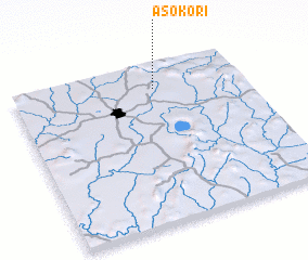 Places with similar names to Asokori, Ghana ::
Disclaimer :: Information on this page comes without warranty of any kind |
||
|
Where is Asokori? Elevation and coordinates ::
Latitude (lat): 6°51'0"N Longitude (lon): 1°23'0"W
Elevation (approx.): 320m (map arrows pan, magnifying glasses zoom) |
||
|
Visiting Asokori? Hotel/Accommodation ::
Book a hotel in Asokori Travel Guide ::
Buy a travel guide for Ghana rental cars ::
car rental offers GPS waypoint ::
download a GPX waypoint (PoI) of Asokori for your GPS receiver
|
||