|
search place name
|
||
Avikope (Ghana)Avikope is a town in Ghana. An overview map of the region around Avikope is displayed below.
regional and 3d topo map of Avikope, Ghana ::

Avikope airports ::
The nearest airport is LFW - Lome Gnassingbe Eyadema Intl, located 77.5 km east of Avikope.
Other airports nearby include ACC - Accra Kotoka Intl (92.2 km south west), COO - Cotonou Cadjehoun (204.0 km east), Nearby towns ::
Depo (0.0km north) //
Agbutokope (1.9km north) //
Kwasizukope (1.9km north) //
Sokpoe (1.9km north) //
Hodikukope (1.9km north) //
Tefle (1.9km north) //
Tawvi (1.8km west) //
Amuvianu (1.8km east) //
Apudum (1.8km east) //
Dekpota (2.6km north west) //
Atropo (2.6km south west) //
Koblakope (2.6km south west) //
Sokpo (2.6km south east) //
Homuamekope (3.7km north) //
Amedikukope (3.7km west) //
Gbemokofe (3.7km east) //
Bunikoshikope (3.7km south) //
Ablibukope (4.1km north west) //
Ameblikofe (4.1km north west) //
Agogbe (4.1km north west) //
Desakwe (4.1km north west) //
Tohuya (4.1km north west) //
Sogakofe (4.1km north east) //
Dedo (4.1km south west) //
Ahakukope (4.1km south west) //
Amakwadikope (4.1km south east) //
Womenyi (4.1km south east) //
Vume (5.2km north west) //
Agudekope (5.2km south west) //
[all distances 'as the bird flies' and approximate] 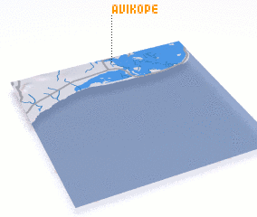 Places with similar names to Avikope, Ghana ::
Disclaimer :: Information on this page comes without warranty of any kind |
||
|
Where is Avikope? Elevation and coordinates ::
Latitude (lat): 5°58'0"N Longitude (lon): 0°35'0"W
Elevation (approx.): -2m (map arrows pan, magnifying glasses zoom) |
||
|
Visiting Avikope? Hotel/Accommodation ::
Book a hotel in Avikope Travel Guide ::
Buy a travel guide for Ghana rental cars ::
car rental offers GPS waypoint ::
download a GPX waypoint (PoI) of Avikope for your GPS receiver
|
||