|
search place name
|
||
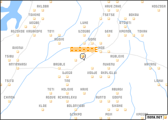
Awahame (Ghana)Awahame is a town in Ghana. An overview map of the region around Awahame is displayed below.
regional and 3d topo map of Awahame, Ghana ::
Awahame airports ::
The nearest airport is LFW - Lome Gnassingbe Eyadema Intl, located 101.9 km south east of Awahame.
Other airports nearby include ACC - Accra Kotoka Intl (126.9 km south west), COO - Cotonou Cadjehoun (217.3 km east), Nearby towns ::
Sokode Etoe (1.8km west) //
Lokoe (1.9km north) //
Hoviofe (1.9km north) //
Kodjobi (2.6km south east) //
Tsawunu (2.6km north east) //
Demete (3.7km north) //
Vodje (4.1km south east) //
Dome (4.1km north east) //
Ahoe (4.1km north east) //
Ho (4.1km north east) //
Achatime (4.1km north east) //
Dome (4.1km north east) //
Djega (5.2km south west) //
Dadome (5.2km south east) //
Bankoe (5.2km north east) //
Dzogbe (5.6km north) //
Bagble (5.8km west) //
Nuwenu (5.8km east) //
Nuwe (5.8km east) //
Tre (6.7km south west) //
Deto (6.7km south west) //
Akpliglui (6.7km south east) //
Agove (6.7km north west) //
Have (7.4km south) //
Agbleve (7.4km east) //
Lume (7.4km north) //
Akrofu (7.8km north west) //
Deme (7.8km north east) //
Holeve (8.3km south west) //
[all distances 'as the bird flies' and approximate] 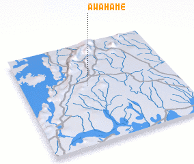
Disclaimer :: Information on this page comes without warranty of any kind |
||
|
Where is Awahame? Elevation and coordinates ::
Latitude (lat): 6°35'0"N Longitude (lon): 0°26'0"W
Elevation (approx.): 172m (map arrows pan, magnifying glasses zoom) |
||
|
Visiting Awahame? Hotel/Accommodation ::
Book a hotel in Awahame Travel Guide ::
Buy a travel guide for Ghana rental cars ::
car rental offers GPS waypoint ::
download a GPX waypoint (PoI) of Awahame for your GPS receiver
|
||