|
search place name
|
||
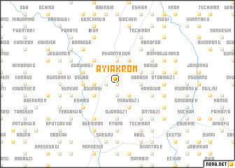
Ayiakrom (Ghana)Ayiakrom is a town in Ghana. An overview map of the region around Ayiakrom is displayed below.
regional and 3d topo map of Ayiakrom, Ghana ::
Ayiakrom airports ::
The nearest airport is ACC - Accra Kotoka Intl, located 94.3 km east of Ayiakrom.
Other airports nearby include TKD - Takoradi (102.0 km south west), NYI - Sunyani (266.2 km north west), Nearby towns ::
Kwami Chwika (0.0km north) //
Abowinim (1.9km north) //
Asempaneye (1.9km south) //
Esadzi (1.9km south) //
Ankukrom (1.8km west) //
Nkojo (2.6km south east) //
Abaasa (3.7km east) //
Nkwantanum (3.7km north) //
Esiam (3.7km north) //
Obum (3.7km west) //
Kromem (4.1km north east) //
Enyan Denkyira (4.1km north east) //
Nsawadzi (4.1km south east) //
Budukwa (4.1km south east) //
Odumasi (4.1km south west) //
Danko (5.2km north west) //
Ojamadzi (5.6km south) //
Osubo (5.5km west) //
Ofebi (5.5km west) //
Mando (5.8km east) //
Owawmasi (5.8km west) //
Hamakwa (5.8km east) //
Abontsa (6.7km south east) //
Owang (6.7km north east) //
Ajumako (6.7km north east) //
Asasang (6.7km north east) //
Enyanmem (6.7km south west) //
Eshiro (6.7km south west) //
Otobiadzi (7.4km east) //
[all distances 'as the bird flies' and approximate] 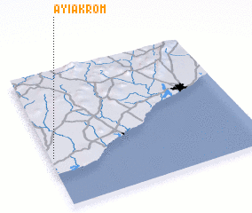 Places with similar names to Ayiakrom, Ghana ::
// Ayakoromo (NG)
Disclaimer :: Information on this page comes without warranty of any kind |
||
|
Where is Ayiakrom? Elevation and coordinates ::
Latitude (lat): 5°22'0"N Longitude (lon): 0°59'0"W
Elevation (approx.): 47m (map arrows pan, magnifying glasses zoom) |
||
|
Visiting Ayiakrom? Hotel/Accommodation ::
Book a hotel in Ayiakrom Travel Guide ::
Buy a travel guide for Ghana rental cars ::
car rental offers GPS waypoint ::
download a GPX waypoint (PoI) of Ayiakrom for your GPS receiver
|
||