|
search place name
|
||
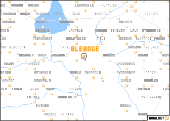
Blebage (Ghana)Blebage is a town in Ghana. An overview map of the region around Blebage is displayed below.
regional and 3d topo map of Blebage, Ghana ::
Blebage airports ::
The nearest airport is LRL - Niatougou Niamtougou International, located 115.6 km south east of Blebage.
Other airports nearby include TML - Tamale (126.9 km south west), Nearby towns ::
Mambanbole (1.9km north) //
Lamirem (1.8km west) //
Pechinaboi (2.6km south east) //
Senjituogo (4.1km north west) //
Nanyuni (4.1km north west) //
Tempango (4.1km south east) //
Nabila (4.1km south west) //
Itele (5.2km north east) //
Kponchiga (5.2km south east) //
Nadere (5.5km east) //
Junjungo (5.5km west) //
Jakpele (5.9km north) //
Wogu (5.9km south east) //
Nabuom (6.6km north east) //
Kukpanga (7.4km south) //
Fieso (7.6km north) //
Oberade (7.6km south) //
Kpembik (7.6km south) //
Namuibui (8.3km north west) //
Tembuon (9.2km north east) //
Manie (10.4km south west) //
[all distances 'as the bird flies' and approximate]  Places with similar names to Blebage, Ghana ::
Disclaimer :: Information on this page comes without warranty of any kind |
||
|
Where is Blebage? Elevation and coordinates ::
Latitude (lat): 10°10'0"N Longitude (lon): 0°7'0"W
Elevation (approx.): 173m (map arrows pan, magnifying glasses zoom) |
||
|
Visiting Blebage? Hotel/Accommodation ::
Book a hotel in Blebage Travel Guide ::
Buy a travel guide for Ghana rental cars ::
car rental offers GPS waypoint ::
download a GPX waypoint (PoI) of Blebage for your GPS receiver
|
||