|
search place name
|
||
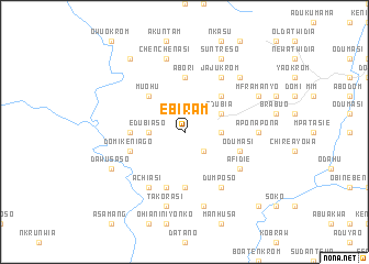
Ebiram (Ghana)Ebiram is a town in Ghana. An overview map of the region around Ebiram is displayed below.
regional and 3d topo map of Ebiram, Ghana ::
Ebiram airports ::
The nearest airport is NYI - Sunyani, located 115.4 km north of Ebiram.
Other airports nearby include TKD - Takoradi (165.8 km south), ACC - Accra Kotoka Intl (217.1 km south east), ABJ - Abidjan Felix Houphouet Boigny Intl (250.0 km south west), Nearby towns ::
Kumpese (2.6km south east) //
Akwasi Akwasiso (2.6km south east) //
Edubiaso (3.7km west) //
Nyankumasi Kese (3.7km east) //
Edubia (4.1km north east) //
Muohu (5.2km north west) //
Asuadai (5.2km north east) //
Abori (5.6km north) //
Kwabenaso (5.5km west) //
Konuasi (5.6km south) //
Domi Keniago (5.8km west) //
Odumasi (5.8km east) //
Nkrang (5.9km south) //
Afidie (6.7km south east) //
Achiasi (6.7km south west) //
Jajukrom (6.7km north east) //
Dumposo (6.7km south east) //
Aponapona (7.4km east) //
Takorasi (7.6km south) //
Fawotriche (7.6km south) //
Chenchenasi (7.6km north) //
Domi Beposo (7.8km north east) //
Dawusaso (8.2km south west) //
Suntreso (8.3km north east) //
Mframanyo (8.2km north east) //
Atutuma (9.2km north west) //
Mosikrom (10.5km south east) //
[all distances 'as the bird flies' and approximate] 
Disclaimer :: Information on this page comes without warranty of any kind |
||
|
Where is Ebiram? Elevation and coordinates ::
Latitude (lat): 6°23'0"N Longitude (lon): 1°58'0"W
Elevation (approx.): 169m (map arrows pan, magnifying glasses zoom) |
||
|
Visiting Ebiram? Hotel/Accommodation ::
Book a hotel in Ebiram Travel Guide ::
Buy a travel guide for Ghana rental cars ::
car rental offers GPS waypoint ::
download a GPX waypoint (PoI) of Ebiram for your GPS receiver
|
||