|
search place name
|
||
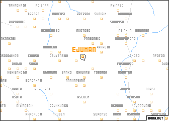
Ejuman (Ghana)Ejuman is a town in Ghana. An overview map of the region around Ejuman is displayed below.
regional and 3d topo map of Ejuman, Ghana ::
Ejuman airports ::
The nearest airport is ACC - Accra Kotoka Intl, located 103.9 km east of Ejuman.
Other airports nearby include TKD - Takoradi (116.2 km south west), NYI - Sunyani (228.6 km north west), Nearby towns ::
Nuadan (1.8km west) //
Adema (2.6km south east) //
Ohiumasi (3.7km south) //
Prabonso (4.1km north east) //
Amipakwebi (4.1km north east) //
Banko (5.2km south west) //
Toboasi (5.2km south east) //
Esikaso (5.2km north east) //
Abomanso (5.6km south) //
Akotoso (5.6km north) //
Obuyensum (5.5km west) //
Anamapenin (5.9km south) //
Asemena (5.8km west) //
Ohameda (7.6km west) //
Edumenu (8.3km south west) //
Frantin (9.2km north west) //
Akenkawso (9.2km north west) //
Akosa (9.2km north east) //
Edumasa (10.5km south west) //
Asukawkaw (10.5km south east) //
Subiriso (10.5km north east) //
[all distances 'as the bird flies' and approximate] 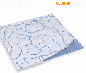
Disclaimer :: Information on this page comes without warranty of any kind |
||
|
Where is Ejuman? Elevation and coordinates ::
Latitude (lat): 5°42'0"N Longitude (lon): 1°6'0"W
Elevation (approx.): 164m (map arrows pan, magnifying glasses zoom) |
||
|
Visiting Ejuman? Hotel/Accommodation ::
Book a hotel in Ejuman Travel Guide ::
Buy a travel guide for Ghana rental cars ::
car rental offers GPS waypoint ::
download a GPX waypoint (PoI) of Ejuman for your GPS receiver
|
||