|
search place name
|
||
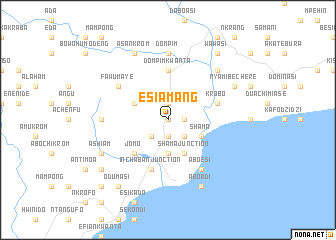
Esiamang (Ghana)Esiamang is a town in Ghana. An overview map of the region around Esiamang is displayed below.
regional and 3d topo map of Esiamang, Ghana ::
Esiamang airports ::
The nearest airport is TKD - Takoradi, located 19.3 km south west of Esiamang.
Other airports nearby include ACC - Accra Kotoka Intl (177.9 km east), Nearby towns ::
Apimenim (0.0km north) //
Kisi Kwanta (1.9km south) //
Asawku (1.9km north) //
Yabin (1.8km east) //
Komfeku (2.6km south west) //
Nkwanta (2.6km south east) //
Nyankrom (3.7km south) //
Shama Junction (4.1km south east) //
Botawjwina (4.1km north west) //
Shama (4.1km south east) //
Jomo (5.2km south west) //
Dompimkwanta (5.6km north) //
Inchaban Junction (5.9km south) //
Inchaban (5.9km south) //
Krobo (5.8km east) //
Aboesi (6.7km south east) //
Fawumaye (6.7km north west) //
Ntamakrom (7.4km west) //
Dompim (7.4km north) //
Achureboana (7.8km north east) //
Ashiam (8.3km south west) //
Aboadi (8.3km south east) //
Asankrom (8.3km north west) //
Nyamibechere (8.3km north east) //
Mpinti (9.3km south west) //
Odumasi (9.3km south west) //
Anoe (9.2km south west) //
Wawasi (9.3km north east) //
Ahinkofikrom (10.5km south west) //
[all distances 'as the bird flies' and approximate] 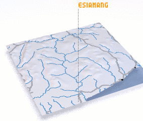 Places with similar names to Esiamang, Ghana :: Disclaimer :: Information on this page comes without warranty of any kind |
||
|
Where is Esiamang? Elevation and coordinates ::
Latitude (lat): 5°2'0"N Longitude (lon): 1°40'0"W
Elevation (approx.): 29m (map arrows pan, magnifying glasses zoom) |
||
|
Visiting Esiamang? Hotel/Accommodation ::
Book a hotel in Esiamang Travel Guide ::
Buy a travel guide for Ghana rental cars ::
car rental offers GPS waypoint ::
download a GPX waypoint (PoI) of Esiamang for your GPS receiver
|
||