|
search place name
|
||
Fwidiem (Ghana)Fwidiem is a town in Ghana. An overview map of the region around Fwidiem is displayed below.
regional and 3d topo map of Fwidiem, Ghana ::

Fwidiem airports ::
The nearest airport is NYI - Sunyani, located 99.5 km north west of Fwidiem.
Other airports nearby include TKD - Takoradi (192.1 km south), ACC - Accra Kotoka Intl (213.6 km south east), Nearby towns ::
Jankoba (1.8km west) //
Toasi (2.6km north west) //
Nkawie Panyin (3.7km north) //
Wioso (4.1km north west) //
Nkurang (4.1km north east) //
Nkawiekuma (4.1km north west) //
Trebuom (5.2km south east) //
Ofuasi (5.5km east) //
Samaso (5.5km west) //
Sedi (5.8km west) //
Mpesetia (5.8km west) //
Domiabra (5.9km south) //
Niamibechere (5.9km south) //
Tanansi (6.7km north west) //
Ohiasumawu (6.7km north east) //
Edu Womasi (6.7km south east) //
Nerebehi (7.4km north) //
Akrofrom (7.4km north) //
Jwehen (7.4km north) //
Winiso (7.6km south) //
Mahami (7.6km west) //
Afrancho (7.6km east) //
Aboabo (7.6km north) //
Aferi (7.6km north) //
Kobi (7.6km north) //
Twedie (7.6km east) //
Yaobuokrom (7.8km north west) //
Amanchia (7.8km south west) //
Yaokwachikrom (8.3km south east) //
[all distances 'as the bird flies' and approximate] 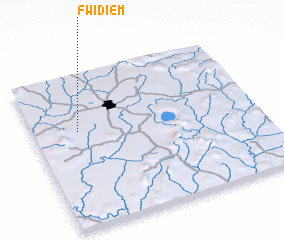
Disclaimer :: Information on this page comes without warranty of any kind |
||
|
Where is Fwidiem? Elevation and coordinates ::
Latitude (lat): 6°38'0"N Longitude (lon): 1°48'0"W
Elevation (approx.): 226m (map arrows pan, magnifying glasses zoom) |
||
|
Visiting Fwidiem? Hotel/Accommodation ::
Book a hotel in Fwidiem Travel Guide ::
Buy a travel guide for Ghana rental cars ::
car rental offers GPS waypoint ::
download a GPX waypoint (PoI) of Fwidiem for your GPS receiver
|
||