|
search place name
|
||
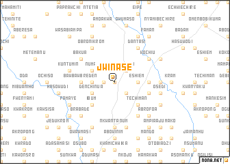
Jwinase (Ghana)Jwinase is a town in Ghana. An overview map of the region around Jwinase is displayed below.
regional and 3d topo map of Jwinase, Ghana ::
Jwinase airports ::
The nearest airport is ACC - Accra Kotoka Intl, located 91.8 km east of Jwinase.
Other airports nearby include TKD - Takoradi (108.1 km south west), NYI - Sunyani (257.1 km north west), Nearby towns ::
Biseasi (0.0km north) //
Abensia (1.8km west) //
Kokoben (2.6km north east) //
Brofoyedru (2.6km south east) //
Sinchem (2.6km south east) //
Kumasi (2.6km south east) //
Eshiem (3.7km east) //
Aku (3.7km west) //
Numa (4.1km north west) //
Denchinua (4.1km south west) //
Techiman (5.2km south east) //
Ibum (5.2km south west) //
Entumbil (5.5km east) //
Ba (5.5km east) //
Bawbawbreden (5.5km west) //
Chebi (5.8km east) //
Amia (5.8km east) //
Ntenanta (5.8km east) //
Wochiu (6.7km north east) //
Ajumako (6.7km south east) //
Dantasi (6.7km north east) //
Asasang (6.7km south east) //
Bakua (6.7km north west) //
Obronikrom (6.7km north west) //
Dawurampong (7.4km east) //
Nkwantanum (7.4km south) //
Esiam (7.4km south) //
Osedi (7.6km east) //
Enyan Denkyira (7.6km south) //
[all distances 'as the bird flies' and approximate] 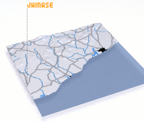 Places with similar names to Jwinase, Ghana ::
// Jwinasi (GH)
Disclaimer :: Information on this page comes without warranty of any kind |
||
|
Where is Jwinase? Elevation and coordinates ::
Latitude (lat): 5°28'0"N Longitude (lon): 0°59'0"W
Elevation (approx.): 77m (map arrows pan, magnifying glasses zoom) |
||
|
Visiting Jwinase? Hotel/Accommodation ::
Book a hotel in Jwinase Travel Guide ::
Buy a travel guide for Ghana rental cars ::
car rental offers GPS waypoint ::
download a GPX waypoint (PoI) of Jwinase for your GPS receiver
|
||