|
search place name
|
||
Keyilo (Ghana)Keyilo is a town in Ghana. An overview map of the region around Keyilo is displayed below.
regional and 3d topo map of Keyilo, Ghana ::

Keyilo airports ::
The nearest airport is TML - Tamale, located 154.7 km south of Keyilo.
Other airports nearby include OUA - Ouagadougou (162.9 km north), Nearby towns ::
Nangwao (2.6km south west) //
Saboro (2.6km south east) //
Babili (2.6km north east) //
Nyania (4.1km north east) //
Navrongo (4.9km south east) //
Namolo (5.2km south east) //
Zinga (5.2km north east) //
Yagwenia (5.6km south) //
Bwania (5.6km south) //
Nabio (5.5km west) //
Bavugunia (5.8km east) //
Nagalakinia (5.9km south) //
Paga (6.6km north) //
Adung (6.6km north west) //
Pinda (6.6km north west) //
Nawgsenia (6.6km south east) //
Kadoro (6.6km north west) //
Beluo (6.6km north east) //
Kwarania (7.6km south) //
Avogonia (7.6km north) //
Chania (7.8km north east) //
Yetuonia (8.2km south east) //
Paga Buru (8.2km north east) //
Navio (8.2km north east) //
Yipala (10.4km south west) //
Bwania (10.4km north east) //
[all distances 'as the bird flies' and approximate] 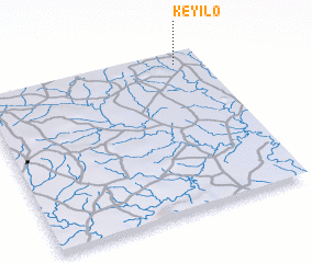 Places with similar names to Keyilo, Ghana ::
Disclaimer :: Information on this page comes without warranty of any kind |
||
|
Where is Keyilo? Elevation and coordinates ::
Latitude (lat): 10°56'0"N Longitude (lon): 1°7'0"W
Elevation (approx.): 216m (map arrows pan, magnifying glasses zoom) |
||
|
Visiting Keyilo? Hotel/Accommodation ::
Book a hotel in Keyilo Travel Guide ::
Buy a travel guide for Ghana rental cars ::
car rental offers GPS waypoint ::
download a GPX waypoint (PoI) of Keyilo for your GPS receiver
|
||