|
search place name
|
||
Klukpe (Ghana)Klukpe is a town in Ghana. An overview map of the region around Klukpe is displayed below.
regional and 3d topo map of Klukpe, Ghana ::

Klukpe airports ::
The nearest airport is LFW - Lome Gnassingbe Eyadema Intl, located 13.9 km east of Klukpe.
Other airports nearby include COO - Cotonou Cadjehoun (140.6 km east), ACC - Accra Kotoka Intl (155.4 km west), Nearby towns ::
Blagpadu (0.0km north) //
Gblefedo (0.4km south) //
Atsukope (1.6km south west) //
Gamadzra (1.7km east) //
Agome (1.8km west) //
Danome (1.9km south) //
Agoveme (1.9km south) //
Okokima (1.8km east) //
Yama (1.9km north) //
Anguenu (1.9km north) //
Bugbumi (1.9km north) //
Haglakofe (2.0km south) //
Awunu (2.0km north) //
Tokor (2.3km south) //
Adidotoe (2.3km west) //
Aveyigbome (2.4km north west) //
Kofeyi (2.4km west) //
Kpogli (2.6km north west) //
Viefegula (2.6km north east) //
Kpanu (2.7km north east) //
Lakluivikope (2.8km south) //
Betsima (2.9km north) //
Ablekpui (3.0km east) //
Nyame Agbogbome (3.0km north west) //
Kpogedi (3.1km south west) //
Darege (3.2km north) //
Kofega (3.3km west) //
Adedido (3.4km north) //
Zogbe (3.5km east) //
[all distances 'as the bird flies' and approximate] 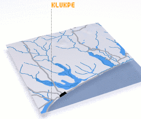 Places with similar names to Klukpe, Ghana ::
Disclaimer :: Information on this page comes without warranty of any kind |
||
|
Where is Klukpe? Elevation and coordinates ::
Latitude (lat): 6°8'0"N Longitude (lon): 1°8'0"E
Elevation (approx.): 26m (map arrows pan, magnifying glasses zoom) |
||
|
Visiting Klukpe? Hotel/Accommodation ::
Book a hotel in Klukpe Travel Guide ::
Buy a travel guide for Ghana rental cars ::
car rental offers GPS waypoint ::
download a GPX waypoint (PoI) of Klukpe for your GPS receiver
|
||