|
search place name
|
||
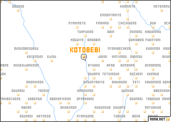
Kotobebi (Ghana)Kotobebi is a town in Ghana. An overview map of the region around Kotobebi is displayed below.
regional and 3d topo map of Kotobebi, Ghana ::
Kotobebi airports ::
The nearest airport is TKD - Takoradi, located 80.6 km south west of Kotobebi.
Other airports nearby include ACC - Accra Kotoka Intl (122.2 km east), NYI - Sunyani (247.6 km north west), Nearby towns ::
Ayiwasi (2.6km south east) //
Jakai (3.7km east) //
Krua (3.7km south) //
Muawanu (3.7km south) //
Kwasama (4.1km north west) //
Mogwiye (4.1km north west) //
Amoabin (4.1km north east) //
Oduafo (4.1km south east) //
Tumfukro (5.6km north) //
Nyamibebu (5.6km south) //
Afao (5.8km east) //
Onsunyamiye (5.9km south) //
Amanporo (6.7km south east) //
Tetikasum (6.7km south east) //
Ejisu (7.4km west) //
Minyinasi (7.4km east) //
Mpenkrom (7.4km south) //
Nyamineye (7.6km north) //
Mereadan (7.6km east) //
Nyamibechere (7.6km east) //
Jesikrom (7.6km south) //
Abin (7.8km north east) //
Esamang (7.8km south east) //
Framasi (8.3km north east) //
Asin Kumasi (8.3km south east) //
Amuakromakrofo (9.3km north east) //
Ahwiawom (9.2km south east) //
Asuboa (10.5km north east) //
[all distances 'as the bird flies' and approximate] 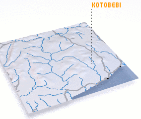 Places with similar names to Kotobebi, Ghana ::
Disclaimer :: Information on this page comes without warranty of any kind |
||
|
Where is Kotobebi? Elevation and coordinates ::
Latitude (lat): 5°24'0"N Longitude (lon): 1°15'0"W
Elevation (approx.): 127m (map arrows pan, magnifying glasses zoom) |
||
|
Visiting Kotobebi? Hotel/Accommodation ::
Book a hotel in Kotobebi Travel Guide ::
Buy a travel guide for Ghana rental cars ::
car rental offers GPS waypoint ::
download a GPX waypoint (PoI) of Kotobebi for your GPS receiver
|
||