|
search place name
|
||
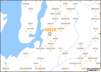
Kpeve (Ghana)Kpeve is a town in Ghana. An overview map of the region around Kpeve is displayed below.
regional and 3d topo map of Kpeve, Ghana ::
Kpeve airports ::
The nearest airport is LFW - Lome Gnassingbe Eyadema Intl, located 116.9 km south east of Kpeve.
Other airports nearby include ACC - Accra Kotoka Intl (131.5 km south west), Nearby towns ::
Toveme (1.9km south) //
Akloba (1.8km east) //
Bame (2.6km south east) //
Wegbe (3.7km south) //
Agodome (3.7km north) //
Wodze (3.7km north) //
Kwawu (3.7km north) //
Vume (4.1km south west) //
Todome (4.1km north east) //
Kpale (4.1km north east) //
Todome (5.2km north east) //
Kadakofe (5.6km south) //
Agute (5.9km north) //
Adzokoe (6.7km south west) //
Atunde (6.7km south east) //
Toyi (6.7km south east) //
Tsiranumu (6.7km north east) //
Etoe (6.7km north east) //
Avenui (6.7km north east) //
Kpawula (7.6km west) //
Walibu (7.6km west) //
Akleme (7.6km north) //
Have Tsebi (7.6km north) //
Gbogame (7.8km north east) //
Akrofu (7.8km south east) //
Beme (8.2km north west) //
Agove (9.2km south east) //
Anfoeta Tsebi (9.2km north east) //
[all distances 'as the bird flies' and approximate] 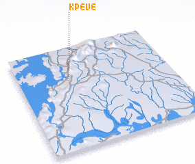 Places with similar names to Kpeve, Ghana ::
Disclaimer :: Information on this page comes without warranty of any kind |
||
|
Where is Kpeve? Elevation and coordinates ::
Latitude (lat): 6°41'0"N Longitude (lon): 0°20'0"W
Elevation (approx.): 133m (map arrows pan, magnifying glasses zoom) |
||
|
Visiting Kpeve? Hotel/Accommodation ::
Book a hotel in Kpeve Travel Guide ::
Buy a travel guide for Ghana rental cars ::
car rental offers GPS waypoint ::
download a GPX waypoint (PoI) of Kpeve for your GPS receiver
|
||