|
search place name
|
||
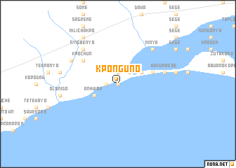
Kponguno (Ghana)Kponguno is a town in Ghana. An overview map of the region around Kponguno is displayed below.
regional and 3d topo map of Kponguno, Ghana ::
Kponguno airports ::
The nearest airport is ACC - Accra Kotoka Intl, located 51.2 km west of Kponguno.
Other airports nearby include LFW - Lome Gnassingbe Eyadema Intl (117.9 km east), Nearby towns ::
Mangochonya (0.0km north) //
Ayitepa (1.9km north) //
Numwepu (1.8km west) //
Luchubwe (2.6km north east) //
Lekponguno (4.1km north east) //
Anhwiam (4.1km south west) //
Omainkope (5.8km east) //
Kpochun (6.7km north west) //
Wokumagbe (7.6km east) //
Nyigbenya (7.8km north west) //
Minya (7.8km north east) //
Buaku (8.3km north west) //
Milichakpo (9.2km north west) //
[all distances 'as the bird flies' and approximate] 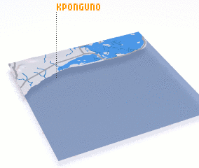 Places with similar names to Kponguno, Ghana ::
// Capanniquian (PH)
// Capanniquian (PH)
// Capungan (PH)
// Kapangan (PH)
// Kapanikian (PH)
// Kapanikian (PH)
// Kopënkino (RU)
// Kapongan (ID)
// Kipungani (KE)
// Kpengnu (GH)
Disclaimer :: Information on this page comes without warranty of any kind |
||
|
Where is Kponguno? Elevation and coordinates ::
Latitude (lat): 5°46'0"N Longitude (lon): 0°16'0"W
Elevation (approx.): -32768m (map arrows pan, magnifying glasses zoom) |
||
|
Visiting Kponguno? Hotel/Accommodation ::
Book a hotel in Kponguno Travel Guide ::
Buy a travel guide for Ghana rental cars ::
car rental offers GPS waypoint ::
download a GPX waypoint (PoI) of Kponguno for your GPS receiver
|
||