|
search place name
|
||
Kumyemua (Ghana)Kumyemua is a town in Ghana. An overview map of the region around Kumyemua is displayed below.
regional and 3d topo map of Kumyemua, Ghana ::

Kumyemua airports ::
The nearest airport is TKD - Takoradi, located 124.0 km south of Kumyemua.
Other airports nearby include NYI - Sunyani (162.7 km north west), ACC - Accra Kotoka Intl (179.4 km east), Nearby towns ::
Dokrowoba (1.8km east) //
Nyamibechire (1.8km west) //
Kubi (1.9km south) //
Lagos (2.6km north east) //
Tsifufunkwanta (2.6km north west) //
Kukuado (2.6km south east) //
Apiayaokrom (3.7km north) //
Jimija (3.7km north) //
Ampunyasi (3.7km north) //
Mangoasi (4.1km north east) //
Oponiyaokrom (4.1km north east) //
Pita (4.1km north west) //
Sodadie (4.1km south west) //
Ampunyanso (5.2km north west) //
Tachikrom (5.2km south west) //
Ofinso (5.2km south west) //
Kwatinkura (5.6km south) //
Betinasi (5.5km east) //
Domiabra (5.9km south) //
Denyansakrom (5.9km south) //
Konkoja (5.8km west) //
Ahinforoso (6.7km south east) //
Eshwenyami (7.4km west) //
Buabinso (7.6km south) //
Achempim (7.6km south) //
Atechem (7.8km south west) //
Adamso (7.8km north west) //
Dunkwa (7.8km south west) //
Wuamasi (8.3km north east) //
[all distances 'as the bird flies' and approximate] 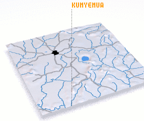 Places with similar names to Kumyemua, Ghana ::
Disclaimer :: Information on this page comes without warranty of any kind |
||
|
Where is Kumyemua? Elevation and coordinates ::
Latitude (lat): 6°1'0"N Longitude (lon): 1°44'0"W
Elevation (approx.): 215m (map arrows pan, magnifying glasses zoom) |
||
|
Visiting Kumyemua? Hotel/Accommodation ::
Book a hotel in Kumyemua Travel Guide ::
Buy a travel guide for Ghana rental cars ::
car rental offers GPS waypoint ::
download a GPX waypoint (PoI) of Kumyemua for your GPS receiver
|
||