|
search place name
|
||
Mbeasi-Nsuta (Ghana)Mbeasi-Nsuta is a town in Ghana. An overview map of the region around Mbeasi-Nsuta is displayed below.
regional and 3d topo map of Mbeasi-Nsuta, Ghana ::

Mbeasi-Nsuta airports ::
The nearest airport is TKD - Takoradi, located 67.6 km south east of Mbeasi-Nsuta.
Other airports nearby include ABJ - Abidjan Felix Houphouet Boigny Intl (193.4 km west), Nearby towns ::
Wawasi (1.9km north) //
Masi (3.7km east) //
Akwadum (3.7km north) //
Nimfrokrom (4.1km south west) //
Bepoasi (4.1km south east) //
Mpeasem (4.1km north west) //
Asantikrom (4.1km south west) //
Ajaw (5.6km north) //
Aniantintem (5.9km north) //
Fanchenebra (5.8km west) //
Kutukrom (5.9km south) //
Huniaboi (5.8km east) //
Betebon (6.7km south east) //
Kotochere (6.7km south east) //
Notiem (7.4km south) //
Babianiha (7.4km north) //
Ankra (7.8km north east) //
Nyamadiama (8.3km north west) //
Anfaja (8.3km north east) //
Bondai (8.3km north east) //
Nkrang (9.2km north east) //
Sunwinaboi (10.5km north east) //
[all distances 'as the bird flies' and approximate] 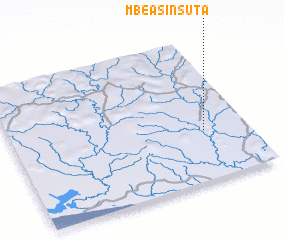 Places with similar names to Mbeasi-Nsuta, Ghana ::
// Mason City (US)
// Mission City (US)
// Mason City (US)
// Măzănăeşti (RO)
// Mesineşti (RO)
// Mason City (US)
// Mason City (US)
// Mason City (US)
Disclaimer :: Information on this page comes without warranty of any kind |
||
|
Where is Mbeasi-Nsuta? Elevation and coordinates ::
Latitude (lat): 5°21'0"N Longitude (lon): 2°11'0"W
Elevation (approx.): 70m (map arrows pan, magnifying glasses zoom) |
||
|
Visiting Mbeasi-Nsuta? Hotel/Accommodation ::
Book a hotel in Mbeasi-Nsuta Travel Guide ::
Buy a travel guide for Ghana rental cars ::
car rental offers GPS waypoint ::
download a GPX waypoint (PoI) of Mbeasi-Nsuta for your GPS receiver
|
||