|
search place name
|
||
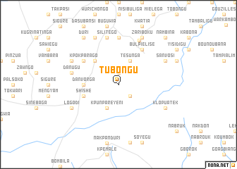
Tubongu (Ghana)Tubongu is a town in Ghana. An overview map of the region around Tubongu is displayed below.
regional and 3d topo map of Tubongu, Ghana ::
Tubongu airports ::
The nearest airport is TML - Tamale, located 149.2 km south west of Tubongu.
Other airports nearby include LRL - Niatougou Niamtougou International (173.3 km south east), OUA - Ouagadougou (233.1 km north west), Nearby towns ::
Farifari (1.9km north) //
Gwotori (2.6km south east) //
Tesunga (4.1km north east) //
Kpunpareyeni (4.1km south west) //
Bantamfarigu (5.2km north west) //
Danvorga (5.5km west) //
Shishe (5.8km west) //
Kpokparago (6.6km north west) //
Boku (6.6km north east) //
Bulpielise (6.6km north east) //
Kugpela (7.4km north) //
Danugu (7.5km west) //
Silitego (7.6km north) //
Warikambo (7.6km north east) //
Dusibuliga (8.2km north west) //
Belambusi (8.3km north west) //
Logodi (8.2km south west) //
Zariboku (8.3km north east) //
Sanvosi (8.2km north east) //
Klopuatek (8.2km south east) //
Duri (9.2km north west) //
Nambina (10.4km north east) //
[all distances 'as the bird flies' and approximate] 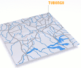 Places with similar names to Tubongu, Ghana ::
Disclaimer :: Information on this page comes without warranty of any kind |
||
|
Where is Tubongu? Elevation and coordinates ::
Latitude (lat): 10°43'0"N Longitude (lon): 0°10'0"W
Elevation (approx.): 215m (map arrows pan, magnifying glasses zoom) |
||
|
Visiting Tubongu? Hotel/Accommodation ::
Book a hotel in Tubongu Travel Guide ::
Buy a travel guide for Ghana rental cars ::
car rental offers GPS waypoint ::
download a GPX waypoint (PoI) of Tubongu for your GPS receiver
|
||