|
search place name
|
||
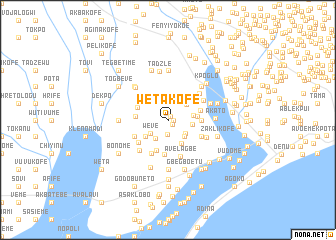
Wetakofe (Ghana)Wetakofe is a town in Ghana. An overview map of the region around Wetakofe is displayed below.
regional and 3d topo map of Wetakofe, Ghana ::
Wetakofe airports ::
The nearest airport is LFW - Lome Gnassingbe Eyadema Intl, located 24.7 km east of Wetakofe.
Other airports nearby include ACC - Accra Kotoka Intl (145.2 km south west), COO - Cotonou Cadjehoun (151.5 km east), Nearby towns ::
Aginukope (0.5km north east) //
Agbosokope (0.6km east) //
Ablamuzadu (0.7km south east) //
Donomadi (1.6km south) //
Weve (2.4km south west) //
Home (2.5km south east) //
Doyakope (2.5km south west) //
Lotame (2.6km south east) //
Adotokope (2.7km north east) //
Golokope (2.8km east) //
Gedekope (2.9km east) //
Lotakor (3.0km south east) //
Adidokope (3.0km south west) //
Amadzikope (3.2km east) //
Gatsikope (3.5km north west) //
Glimate (3.6km south) //
Gyagoto (3.6km west) //
Ehie (3.7km west) //
Kofega (3.7km east) //
Amuatekokope (3.8km south) //
Amedzikope (3.8km east) //
Adrume (4.1km south west) //
Yahuni (4.1km south west) //
Djikome (4.1km south east) //
Kpotsikope (4.1km south west) //
Avelagbe (4.3km south) //
Ahiamadikope (4.4km north east) //
Asogo (4.6km north east) //
Hesuworkope (4.7km south west) //
[all distances 'as the bird flies' and approximate]  Places with similar names to Wetakofe, Ghana ::
// Wedigfa (NG)
Disclaimer :: Information on this page comes without warranty of any kind |
||
|
Where is Wetakofe? Elevation and coordinates ::
Latitude (lat): 6°8'0"N Longitude (lon): 1°2'0"E
Elevation (approx.): 28m (map arrows pan, magnifying glasses zoom) |
||
|
Visiting Wetakofe? Hotel/Accommodation ::
Book a hotel in Wetakofe Travel Guide ::
Buy a travel guide for Ghana rental cars ::
car rental offers GPS waypoint ::
download a GPX waypoint (PoI) of Wetakofe for your GPS receiver
|
||