|
search place name
|
||
Ziwofia (Ghana)Ziwofia is a town in Ghana. An overview map of the region around Ziwofia is displayed below.
regional and 3d topo map of Ziwofia, Ghana ::

Ziwofia airports ::
The nearest airport is LFW - Lome Gnassingbe Eyadema Intl, located 69.1 km south east of Ziwofia.
Other airports nearby include ACC - Accra Kotoka Intl (137.8 km south west), COO - Cotonou Cadjehoun (185.0 km east), Nearby towns ::
Akpokofe (0.0km north) //
Agadji (1.8km east) //
Essankopé (1.8km east) //
Blétérikopé (1.8km east) //
Lavouékopé (1.9km north) //
Agbokofe (1.9km north) //
Kpota (2.6km south west) //
Sevo (2.6km south west) //
Adidome (2.6km north west) //
Agovi (3.7km south) //
Adjovime (3.7km south) //
Kpeve (3.7km south) //
Batoumé (3.7km east) //
Gokofe (3.7km west) //
Agblega (3.7km west) //
Takuvi (4.1km south east) //
Zomai (4.1km south east) //
Gbakopé (4.1km north east) //
Vudasi (4.1km south west) //
Agbomadjikofe (4.1km south west) //
Kpedekpo (4.1km south west) //
Zochiakofe (4.1km south west) //
Ankoukopé (4.1km north east) //
Kamasakofe (5.2km south west) //
Wo Kopé (5.2km north east) //
Djaremave (5.6km south) //
Gokofe (5.6km south) //
Letsoukopé (5.6km north) //
Kpotavi (5.9km south) //
[all distances 'as the bird flies' and approximate] 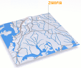
Disclaimer :: Information on this page comes without warranty of any kind |
||
|
Where is Ziwofia? Elevation and coordinates ::
Latitude (lat): 6°29'0"N Longitude (lon): 0°43'0"W
Elevation (approx.): 79m (map arrows pan, magnifying glasses zoom) |
||
|
Visiting Ziwofia? Hotel/Accommodation ::
Book a hotel in Ziwofia Travel Guide ::
Buy a travel guide for Ghana rental cars ::
car rental offers GPS waypoint ::
download a GPX waypoint (PoI) of Ziwofia for your GPS receiver
|
||