|
search place name
|
||
Arechuyvo (Chihuahua, Mexico)Arechuyvo is a town in the Chihuahua region of Mexico. An overview map of the region around Arechuyvo is displayed below.
regional and 3d topo map of Arechuyvo, Mexico ::

Arechuyvo airports ::
The nearest airport is CEN - Ciudad Obregon Intl, located 137.9 km west of Arechuyvo.
Nearby towns ::
Noriega (1.9km north) //
Toyachic (3.3km west) //
Pilas (3.8km north east) //
Palo Amarillo (3.8km south east) //
Tojiáchic de Abajo (4.1km south west) //
Bacabuico (3.8km north west) //
San José del Pinal (4.9km south east) //
Bacugachic (5.6km north) //
Santa Rosa (5.6km south) //
Calabazas (5.3km east) //
La Cañita (6.2km north east) //
Aliso (7.4km north) //
Tepehuiachiac (7.4km north east) //
Palo Dulce (7.5km north west) //
San Juan (8.6km north west) //
Sipachic (8.9km north east) //
Ranchería (9.9km south east) //
Guicharaibo (9.9km north west) //
[all distances 'as the bird flies' and approximate] 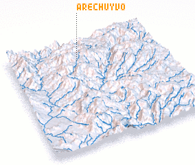 Places with similar names to Arechuyvo, Mexico ::
Disclaimer :: Information on this page comes without warranty of any kind |
||
|
Where is Arechuyvo? Elevation and coordinates ::
Latitude (lat): 27°51'0"N Longitude (lon): 108°32'0"W
Elevation (approx.): 1394m (map arrows pan, magnifying glasses zoom) |
||
|
Visiting Arechuyvo? Hotel/Accommodation ::
Book a hotel in Arechuyvo Travel Guide ::
Buy a travel guide for Mexico rental cars ::
car rental offers GPS waypoint ::
download a GPX waypoint (PoI) of Arechuyvo for your GPS receiver
|
||