|
search place name
|
||
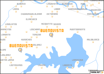
Buenavista (Tamaulipas, Mexico)Buenavista is a town in the Tamaulipas region of Mexico. An overview map of the region around Buenavista is displayed below.
regional and 3d topo map of Buenavista, Mexico ::
Buenavista airports ::
The nearest airport is MFE - Mcallen Mc Allen Miller Intl, located 80.3 km east of Buenavista.
Other airports nearby include REX - Reynosa General Lucio Blanco Intl (86.0 km east), MTY - Monterrey General Mariano Escobedo Intl (121.1 km south west), NTR - Monterrey Del Norte Intl (129.0 km west), HRL - Harlingen Valley Intl (137.9 km east), Nearby towns ::
El Nogalito (4.1km south west) //
Severo (4.1km north east) //
Mezquitito (4.1km north west) //
Tepozán (5.0km west) //
Los Chapotes (5.3km west) //
Los López (6.2km south west) //
Loma Larga (6.6km west) //
Victoriano (7.4km north) //
El Pacueco (8.7km north west) //
Ciudad Miguel Alemán (10.0km north west) //
[all distances 'as the bird flies' and approximate] 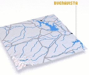 Places with similar names to Buenavista, Mexico ::
// Buenavista (PH)
// Buenavista (PH)
// Buenavista (PH)
// Buenavista (PH)
// Buenavista (PH)
// Buena Vista (PH)
// Buena Vista (PH)
// Buena Vista (PH)
// Buenavista (PH)
// Buenavista (PH)
Disclaimer :: Information on this page comes without warranty of any kind |
||
|
Where is Buenavista? Elevation and coordinates ::
Latitude (lat): 26°17'0"N Longitude (lon): 99°2'0"W
Elevation (approx.): 98m (map arrows pan, magnifying glasses zoom) |
||
|
Visiting Buenavista? Hotel/Accommodation ::
Book a hotel in Buenavista Travel Guide ::
Buy a travel guide for Mexico rental cars ::
car rental offers GPS waypoint ::
download a GPX waypoint (PoI) of Buenavista for your GPS receiver
|
||