|
search place name
|
||
Candelas (Guanajuato, Mexico)Candelas is a town in the Guanajuato region of Mexico. An overview map of the region around Candelas is displayed below.
regional and 3d topo map of Candelas, Mexico ::

Candelas airports ::
The nearest airport is QRO - Queretaro Intercontinental, located 43.1 km north east of Candelas.
Other airports nearby include MLM - Morelia General Francisco J Mujica Intl (79.6 km south west), BJX - Del Bajio Guanajuato Intl (131.8 km north west), TLC - Toluca Licenciado Adolfo Lopez Mateos Intl (141.8 km south east), MEX - Mexico City Licenciado Benito Juarez Intl (173.3 km south east), Nearby towns ::
Rancho Nuevo (3.6km north) //
Palo Colorado (3.6km south east) //
La Presita (4.3km south west) //
Ojo de Agua (4.4km west) //
Cebolleta (4.5km east) //
El Puerto (5.2km east) //
Los Corrales (5.5km south west) //
El Tanquecito (6.1km west) //
La Barranca (6.5km north) //
Tepozán (6.3km north west) //
El Rosario (6.4km east) //
Quemado (7.0km north west) //
Sabanilla (7.2km north east) //
Benítez (7.3km west) //
San Antonio Corrales (7.8km north) //
Fresno (7.6km south west) //
La Ceja de Bravo (7.5km north east) //
San Isidro de la Corregidora (7.9km north) //
El Mono (7.5km west) //
La Ordeña (7.8km west) //
La Esquina (8.3km south west) //
La Cebolleta (8.9km south east) //
Las Tepuzas (9.0km north east) //
Tacambarillo (9.5km south west) //
Cebolletas (9.3km south east) //
Las Taponas (10.1km north east) //
San Ignacio (10.8km south west) //
Santa Cruz de Gamboa (11.5km north west) //
San Isidro de Gamboa (12.0km north west) //
[all distances 'as the bird flies' and approximate] 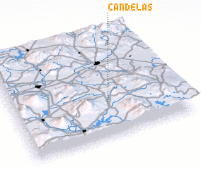 Places with similar names to Candelas, Mexico ::
// Cantelous (US)
// Kindlas (DE)
// Cantelães (PT)
// Gondalães (PT)
// Candolias (ES)
// Gandullas (ES)
// Caño Dulce (CO)
// Canotillos (CO)
// Kandolūs (IR)
// Cañadulce (PE)
Disclaimer :: Information on this page comes without warranty of any kind |
||
|
Where is Candelas? Elevation and coordinates ::
Latitude (lat): 20°18'45"N Longitude (lon): 100°26'36"W
Elevation (approx.): 2440m (map arrows pan, magnifying glasses zoom) |
||
|
Visiting Candelas? Hotel/Accommodation ::
Book a hotel in Candelas Travel Guide ::
Buy a travel guide for Mexico rental cars ::
car rental offers GPS waypoint ::
download a GPX waypoint (PoI) of Candelas for your GPS receiver
|
||