|
search place name
|
||
Carbajal (México, Mexico)Carbajal is a town in the México region of Mexico. An overview map of the region around Carbajal is displayed below.
regional and 3d topo map of Carbajal, Mexico ::

Carbajal airports ::
The nearest airport is TLC - Toluca Licenciado Adolfo Lopez Mateos Intl, located 68.0 km north east of Carbajal.
Other airports nearby include CVJ - Cuernavaca General Mariano Matamoros (77.1 km east), MEX - Mexico City Licenciado Benito Juarez Intl (115.0 km north east), MLM - Morelia General Francisco J Mujica Intl (153.1 km north west), PBC - Puebla Hermanos Serdan Intl (173.4 km east), Nearby towns ::
Nuxtepec (0.9km west) //
Huayatenco (2.8km east) //
Albarrada (2.9km south) //
Pantoja (3.8km north west) //
San Gabriel (4.5km west) //
Sultepec de Pedro Ascencio de Alquisiras (4.5km east) //
El Picacho (4.7km north) //
Real de Abajo (4.7km south) //
Santa Cruz (4.7km south) //
Rastrojo Largo (4.8km north east) //
Yuytepec (5.3km north east) //
La Unión (5.3km south east) //
Santiago Arizmendi (5.7km south west) //
Jesús del Monte (5.7km north east) //
Diego Sánchez (6.1km south east) //
Santo Tomás de las Flores (6.5km south) //
El Maguey (7.0km north) //
Arroyo Seco (6.7km north east) //
Arvallo (7.2km south west) //
Ojo de Agua (7.9km north) //
San Miguel (7.8km north east) //
Los Baños (7.7km north west) //
La Ciénega (7.7km south east) //
Santa Maria (7.7km north east) //
Sultepequito (8.4km south) //
Almoloya de Alquisiras (7.9km east) //
Capula (7.9km east) //
Los Epazotes (8.5km south) //
El Chapaneal (8.6km north east) //
[all distances 'as the bird flies' and approximate] 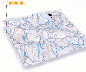 Places with similar names to Carbajal, Mexico ::
// Grabijolai (LT)
// Carbajal (ES)
// Carbajal (ES)
// Carbajal (ES)
// Carbajal (ES)
// Gar Bājāil (BD)
// Carbajal (MX)
// Carbajal (MX)
// Carbajal (PE)
// Carabajal (AR)
Disclaimer :: Information on this page comes without warranty of any kind |
||
|
Where is Carbajal? Elevation and coordinates ::
Latitude (lat): 18°52'30"N Longitude (lon): 99°59'30"W
Elevation (approx.): 1832m (map arrows pan, magnifying glasses zoom) |
||
|
Visiting Carbajal? Hotel/Accommodation ::
Book a hotel in Carbajal Travel Guide ::
Buy a travel guide for Mexico rental cars ::
car rental offers GPS waypoint ::
download a GPX waypoint (PoI) of Carbajal for your GPS receiver
|
||