|
search place name
|
||
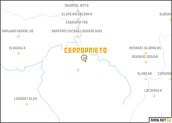
Cerro Prieto (Durango, Mexico)Cerro Prieto is a town in the Durango region of Mexico. An overview map of the region around Cerro Prieto is displayed below.
regional and 3d topo map of Cerro Prieto, Mexico ::
Cerro Prieto airports ::
The nearest airport is CUL - Culiacan Intl, located 215.4 km south west of Cerro Prieto.
Nearby towns ::
Las Joyas (2.5km south west) //
San Francisco de Los Remedios (5.8km north) //
Casas Pintas (7.6km north) //
[all distances 'as the bird flies' and approximate] 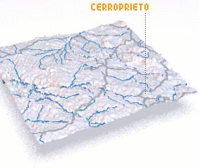 Places with similar names to Cerro Prieto, Mexico ::
// Cerro Prieto (MX)
// Serra Prêta (BR)
// Cerro Prieto (PA)
// Cerro Prieto (MX)
// Cerro Prieto (MX)
// Cerro Prieto (MX)
// Cerro Prieto (MX)
// Cerro Prieto (MX)
// Cerro Prieto (MX)
// Cerro Prieto (MX)
Disclaimer :: Information on this page comes without warranty of any kind |
||
|
Where is Cerro Prieto? Elevation and coordinates ::
Latitude (lat): 26°19'0"N Longitude (lon): 106°11'0"W
Elevation (approx.): 2134m (map arrows pan, magnifying glasses zoom) |
||
|
Visiting Cerro Prieto? Hotel/Accommodation ::
Book a hotel in Cerro Prieto Travel Guide ::
Buy a travel guide for Mexico rental cars ::
car rental offers GPS waypoint ::
download a GPX waypoint (PoI) of Cerro Prieto for your GPS receiver
|
||