|
search place name
|
||
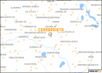
Cerro Prieto (Guanajuato, Mexico)Cerro Prieto is a town in the Guanajuato region of Mexico. An overview map of the region around Cerro Prieto is displayed below.
regional and 3d topo map of Cerro Prieto, Mexico ::
Cerro Prieto airports ::
The nearest airport is BJX - Del Bajio Guanajuato Intl, located 34.3 km north east of Cerro Prieto.
Other airports nearby include ZMM - Zamora (99.9 km south west), MLM - Morelia General Francisco J Mujica Intl (117.1 km south east), AGU - Aguascalientes Jesus Teran Intl (128.5 km north west), UPN - Uruapan Licenciado Y Gen Ignacio Lopez Rayon (152.9 km south), Nearby towns ::
Las Tablas (2.5km north) //
El Paraíso (3.6km south east) //
Ojo de Agua de Guanumo (3.6km east) //
Trojes de Marañón (3.9km south) //
Angostura (4.1km west) //
LaRana (4.7km north) //
Paso del León (4.6km south west) //
Las Trojes del Marañón (4.7km south east) //
San Francisco (5.2km south east) //
Joya de Calvillo (5.3km east) //
San Juan de la Puerta (5.3km west) //
San Isidro de Ojo de Agua (5.9km north) //
María Antonia (6.0km north west) //
Los Homos (6.8km south west) //
La Sarteneja (7.1km south) //
Puerto de la Cruz (7.0km south east) //
El Saucillo (7.2km south west) //
La Batalla (7.5km south west) //
San Agustín (7.3km west) //
Santa Efigenia (8.5km north) //
Los Amoles (8.8km north east) //
La Palma (9.0km south) //
Las Coloradas (8.7km north west) //
Tres Villas (9.3km south) //
Alameda de Alvarez (9.2km south east) //
La Esperanza (9.6km north west) //
La Muralla (9.6km north west) //
Tultitlán (10.6km north west) //
Cruz de Aguilar (10.6km north east) //
[all distances 'as the bird flies' and approximate] 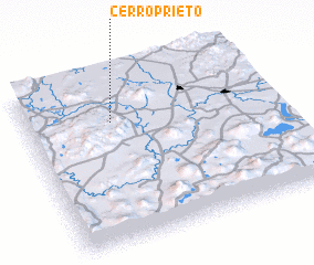 Places with similar names to Cerro Prieto, Mexico ::
// Cerro Prieto (MX)
// Serra Prêta (BR)
// Cerro Prieto (PA)
// Cerro Prieto (MX)
// Cerro Prieto (MX)
// Cerro Prieto (MX)
// Cerro Prieto (MX)
// Cerro Prieto (MX)
// Cerro Prieto (MX)
// Cerro Prieto (MX)
Disclaimer :: Information on this page comes without warranty of any kind |
||
|
Where is Cerro Prieto? Elevation and coordinates ::
Latitude (lat): 20°43'40"N Longitude (lon): 101°39'1"W
Elevation (approx.): 1794m (map arrows pan, magnifying glasses zoom) |
||
|
Visiting Cerro Prieto? Hotel/Accommodation ::
Book a hotel in Cerro Prieto Travel Guide ::
Buy a travel guide for Mexico rental cars ::
car rental offers GPS waypoint ::
download a GPX waypoint (PoI) of Cerro Prieto for your GPS receiver
|
||