|
search place name
|
||
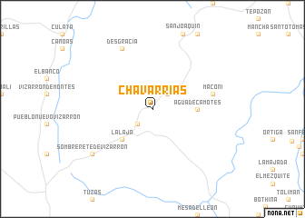
Chavarrías (Querétaro de Arteaga, Mexico)Chavarrías is a town in the Querétaro de Arteaga region of Mexico. An overview map of the region around Chavarrías is displayed below.
regional and 3d topo map of Chavarrías, Mexico ::
Chavarrías airports ::
The nearest airport is QRO - Queretaro Intercontinental, located 65.5 km west of Chavarrías.
Other airports nearby include PCA - Pachuca Ingeniero Juan Guillermo Villasana (119.5 km south east), TSL - Tamuin (156.7 km north east), MEX - Mexico City Licenciado Benito Juarez Intl (164.2 km south), TLC - Toluca Licenciado Adolfo Lopez Mateos Intl (165.7 km south), Nearby towns ::
Puerta (2.5km south west) //
El Doctor (2.5km north east) //
La Laja (5.1km south west) //
Agua de Camotes (5.2km east) //
Maconí (7.2km east) //
Desgracia (8.2km north west) //
Sombrerete de Vizarrón (8.9km south west) //
[all distances 'as the bird flies' and approximate] 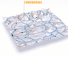 Places with similar names to Chavarrías, Mexico ::
// Chafariz (PT)
// Chuvarez (RU)
// Chāh Fārsī (IR)
// Chāh Varz (IR)
// Cheviers (US)
// Shivers (US)
// Shāh Fīrūz (IR)
// Sīāvarz (IR)
// Chefe Raice (MZ)
// Chefe Rosa (MZ)
Disclaimer :: Information on this page comes without warranty of any kind |
||
|
Where is Chavarrías? Elevation and coordinates ::
Latitude (lat): 20°50'0"N Longitude (lon): 99°36'0"W
Elevation (approx.): 2955m (map arrows pan, magnifying glasses zoom) |
||
|
Visiting Chavarrías? Hotel/Accommodation ::
Book a hotel in Chavarrías Travel Guide ::
Buy a travel guide for Mexico rental cars ::
car rental offers GPS waypoint ::
download a GPX waypoint (PoI) of Chavarrías for your GPS receiver
|
||