|
search place name
|
||
Chicharrones (Tamaulipas, Mexico)Chicharrones is a town in the Tamaulipas region of Mexico. An overview map of the region around Chicharrones is displayed below.
regional and 3d topo map of Chicharrones, Mexico ::

Chicharrones airports ::
The nearest airport is MTY - Monterrey General Mariano Escobedo Intl, located 100.0 km south west of Chicharrones.
Other airports nearby include NTR - Monterrey Del Norte Intl (105.1 km south west), MFE - Mcallen Mc Allen Miller Intl (111.0 km east), REX - Reynosa General Lucio Blanco Intl (116.7 km east), NLD - Nuevo Laredo Quetzalcoatl Intl (123.5 km north), Nearby towns ::
Quiroga (2.5km south west) //
Santo Domingo (3.8km north east) //
Huatempo (5.8km north) //
Tepehuaje (5.3km east) //
Loma Alta (5.3km east) //
El Fresnito (6.2km north west) //
Las Auras (7.4km north) //
El Sauz (7.6km north) //
Jesús (6.9km west) //
Canaleño (7.5km north east) //
Pasito Nuevo (7.6km north east) //
La Prieta (7.6km north west) //
Jabalí (8.1km north east) //
El Ebanito (8.3km south east) //
Malahueco (8.9km north west) //
Quiroga (8.9km north west) //
[all distances 'as the bird flies' and approximate] 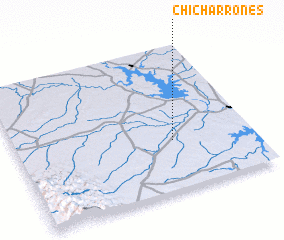 Places with similar names to Chicharrones, Mexico :: Disclaimer :: Information on this page comes without warranty of any kind |
||
|
Where is Chicharrones? Elevation and coordinates ::
Latitude (lat): 26°21'0"N Longitude (lon): 99°20'0"W
Elevation (approx.): 102m (map arrows pan, magnifying glasses zoom) |
||
|
Visiting Chicharrones? Hotel/Accommodation ::
Book a hotel in Chicharrones Travel Guide ::
Buy a travel guide for Mexico rental cars ::
car rental offers GPS waypoint ::
download a GPX waypoint (PoI) of Chicharrones for your GPS receiver
|
||