|
search place name
|
||
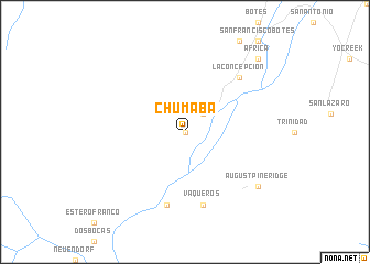
Chumaba (Quintana Roo, Mexico)Chumaba is a town in the Quintana Roo region of Mexico. An overview map of the region around Chumaba is displayed below.
regional and 3d topo map of Chumaba, Mexico ::
Chumaba airports ::
The nearest airport is CTM - Chetumal Intl, located 72.4 km north east of Chumaba.
Other airports nearby include BZE - Belize City Philip S W Goldson Intl (73.0 km south east), CPE - Campeche Ingeniero Alberto Acuna Ongay Intl (269.1 km north west), Nearby towns ::
Santa Teresa (0.0km north) //
Agua Blanca (2.6km north east) //
Vaqueros (7.6km south) //
Corozalito (7.6km south) //
Buenavista (7.7km north east) //
La Concepción (7.7km north east) //
August Pine Ridge (9.0km south east) //
África (10.2km north east) //
[all distances 'as the bird flies' and approximate] 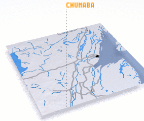 Places with similar names to Chumaba, Mexico ::
Disclaimer :: Information on this page comes without warranty of any kind |
||
|
Where is Chumaba? Elevation and coordinates ::
Latitude (lat): 18°1'0"N Longitude (lon): 88°47'0"W
Elevation (approx.): 57m (map arrows pan, magnifying glasses zoom) |
||
|
Visiting Chumaba? Hotel/Accommodation ::
Book a hotel in Chumaba Travel Guide ::
Buy a travel guide for Mexico rental cars ::
car rental offers GPS waypoint ::
download a GPX waypoint (PoI) of Chumaba for your GPS receiver
|
||