|
search place name
|
||
Cieneguilla (Guanajuato, Mexico)Cieneguilla is a town in the Guanajuato region of Mexico. An overview map of the region around Cieneguilla is displayed below.
regional and 3d topo map of Cieneguilla, Mexico ::

Cieneguilla airports ::
The nearest airport is BJX - Del Bajio Guanajuato Intl, located 57.0 km west of Cieneguilla.
Other airports nearby include QRO - Queretaro Intercontinental (93.2 km south east), SLP - San Luis Potosi Ponciano Arriaga Intl (130.9 km north), MLM - Morelia General Francisco J Mujica Intl (135.6 km south), AGU - Aguascalientes Jesus Teran Intl (159.3 km north west), Nearby towns ::
El Durazno (1.3km south west) //
El Derramadero (2.7km south west) //
Casas Viejas (3.1km south east) //
San José de la Palma (3.3km north) //
La Laja (3.3km north) //
La Jarilla (3.6km south) //
El Potrero (3.8km north east) //
El Potrero (3.9km north east) //
San Sergio (4.8km south west) //
El Llanito (5.1km north) //
Tierra Blanca (5.1km north) //
La Erre (5.1km north east) //
El Potrero (5.4km south) //
Jaralillo (5.2km west) //
Arroyo Seco (5.6km east) //
Santiaguillo (6.2km south) //
El Saucito (6.3km south) //
San Francisco (6.5km north east) //
Joconoxtlito (7.0km north) //
Peñuelitas (7.6km north east) //
Santa Bárbara (7.5km west) //
Montañés (7.5km east) //
El Porvenir (7.9km north east) //
La Caja (8.3km east) //
Las Trojes (8.8km south east) //
El Venado (8.3km east) //
San Pablo (9.0km north) //
Las Adjuntas (9.1km north east) //
Ojo Zarco (9.1km south east) //
[all distances 'as the bird flies' and approximate] 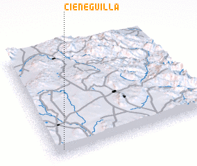 Places with similar names to Cieneguilla, Mexico ::
Disclaimer :: Information on this page comes without warranty of any kind |
||
|
Where is Cieneguilla? Elevation and coordinates ::
Latitude (lat): 21°4'20"N Longitude (lon): 100°56'20"W
Elevation (approx.): 1955m (map arrows pan, magnifying glasses zoom) |
||
|
Visiting Cieneguilla? Hotel/Accommodation ::
Book a hotel in Cieneguilla Travel Guide ::
Buy a travel guide for Mexico rental cars ::
car rental offers GPS waypoint ::
download a GPX waypoint (PoI) of Cieneguilla for your GPS receiver
|
||